
IMAGES TAKEN NEAR TO
Victoria Square, STIRLING, FK8 2RA
Introduction
This page details the photographs taken nearby to Victoria Square, FK8 2RA by members of the Geograph project.
The Geograph project started in 2005 with the aim of publishing, organising and preserving representative images for every square kilometre of Great Britain, Ireland and the Isle of Man.

There are currently over 7.5m images from over14,400 individuals and you can help contribute to the project by visiting https://www.geograph.org.uk
Image Map
Images are licensed for reuse under creativecommons.org/licenses/by-sa/2.0
Notes
- Clicking on the map will re-center to the selected point.
- The higher the marker number, the further away the image location is from the centre of the postcode.
Image Listing (129 Images Found)
Images are licensed for reuse under creativecommons.org/licenses/by-sa/2.0
Image
Details
Distance
1
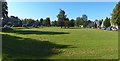
Victoria Square, Stirling
It is shown from the other end in Image
Image: © Lairich Rig
Taken: 21 Sep 2019
0.03 miles
2
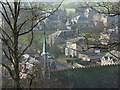
Stirling
The steeple of Holy Trinity Episcopal Church (http://www.geograph.org.uk/photo/250362 ) and houses in Clarendon Place and Victoria Square viewed from the town wall.
Image: © Andrew Smith
Taken: 4 Feb 2007
0.03 miles
3
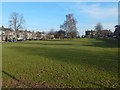
Victoria Square, Stirling
It is shown from the other end in Image The square had not been laid out when the first-edition OS map was surveyed (1858—60), but the second edition (1896) shows it. The group of trees near the centre of the picture is precisely at the centre of the Square.
Albert Place is nearby, and is shown on the first edition of the map; it therefore pre-dates both Victoria Square and the nearby Image
Image: © Lairich Rig
Taken: 24 Feb 2018
0.04 miles
4
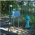
Old drinking fountain
This one, beside one of the entrances of King's Park, is C-listed. It has a ram's head carved at the top. The plaque beside it provides information about all four fountains. Reckoning from north to south, this is the second of them.
Image: © Lairich Rig
Taken: 21 Sep 2019
0.09 miles
5
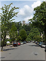
Victoria Place, Stirling
Looking down to Victoria Road with Holy Rude church above.
Image: © Andrew Smith
Taken: 27 Jun 2006
0.09 miles
6
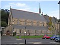
Episcopal Church, Stirling
Looking north-east
Image: © Kenneth Allen
Taken: 25 Sep 2006
0.10 miles
7
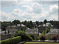
Stirling
Pleasant residential area near the city centre. St Columba's church is in the left of picture.
Image: © Andrew Smith
Taken: 27 Jun 2006
0.11 miles
8
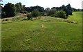
King's Park: remains of the race track
The high ground receding from view is the line of a former race course, shown on the first-edition OS map (surveyed 1858—60). See Image for a view in the opposite direction from the same point.
See Image for a more detailed discussion, with additional comments on a former dam nearby.
Image: © Lairich Rig
Taken: 21 Sep 2019
0.11 miles
9
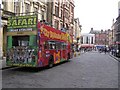
Sight-seeing at Stirling
One way to get to know the place.
Image: © Kenneth Allen
Taken: 25 Sep 2006
0.11 miles
10
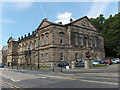
Albert Halls, Stirling
Entertainment and conference venue.
Image: © Andrew Smith
Taken: 27 Jun 2006
0.11 miles