
IMAGES TAKEN NEAR TO
Victoria Place, STIRLING, FK8 2QT
Introduction
This page details the photographs taken nearby to Victoria Place, FK8 2QT by members of the Geograph project.
The Geograph project started in 2005 with the aim of publishing, organising and preserving representative images for every square kilometre of Great Britain, Ireland and the Isle of Man.

There are currently over 7.5m images from over14,400 individuals and you can help contribute to the project by visiting https://www.geograph.org.uk
Image Map
Images are licensed for reuse under creativecommons.org/licenses/by-sa/2.0
Notes
- Clicking on the map will re-center to the selected point.
- The higher the marker number, the further away the image location is from the centre of the postcode.
Image Listing (43 Images Found)
Images are licensed for reuse under creativecommons.org/licenses/by-sa/2.0
Image
Details
Distance
1
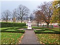
Drinking fountain, Kings Park, Stirling
Image: © Alpin Stewart
Taken: 2 Nov 2014
0.06 miles
2
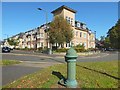
Old drinking fountain
Reckoning from north to south, this is the third of the four fountains; it is at the corner of Victoria Place (shown on the left) and Park Avenue. This picture shows the fountain in context, but a closer look from a different angle shows its distinctive features more clearly: Image
Image: © Lairich Rig
Taken: 21 Sep 2019
0.07 miles
3
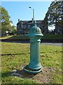
Old drinking fountain
This one is at the corner of Victoria Place and Park Avenue. The projecting dog bowl at the bottom is clearly visible, as is the lion's head carving. See Image for a view of the same fountain in context. Reckoning from north to south, this is the third of the four fountains.
Image: © Lairich Rig
Taken: 21 Sep 2019
0.07 miles
4
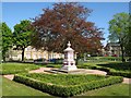
Kings Park Drinking Fountain, Stirling
B listed cast iron structure built by Lion Iron Foundry, Kirkintilloch. It was placed in Kings Park in 1934. Restoration funded by Stirling City Heritage Trust and Friends of Kings Park took place in June 2006.
Image: © G Laird
Taken: 6 May 2017
0.08 miles
5
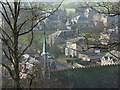
Stirling
The steeple of Holy Trinity Episcopal Church (http://www.geograph.org.uk/photo/250362 ) and houses in Clarendon Place and Victoria Square viewed from the town wall.
Image: © Andrew Smith
Taken: 4 Feb 2007
0.10 miles
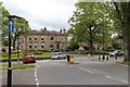
7
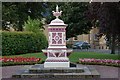
Drinking fountain
This drinking fountain is at Kings Park, it is a B listed cast iron structure, it was cast at the Lion Iron Foundry Kirkintilloch in 1934.
Image: © Paul McIlroy
Taken: 12 Aug 2007
0.12 miles
8
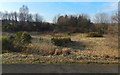
Former gravel pit in King's Park
There is a noticeable hollow here, with a resemblance to a drained body of water, but, as noted at Image, it has a quite different origin: it is labelled "gravel pit" on the first-edition map (1858—60).
Image: © Lairich Rig
Taken: 24 Feb 2018
0.12 miles
9
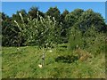
Community Orchard, King's Park
An information panel nearby explains that Friends of King's Park, in partnership with Stirling Council, and with funding from the Forth Valley Orchards initiative, are trying to recreate a small orchard within King's Park, planted with Scottish and heritage varieties of fruit trees.
By way of background, the panel also mentions a Royal Orchard (16th century) in Stirling, thought to have been in the Haining (Image), which is close to Image; see the comments on Image, 800 metres north of here.
Image: © Lairich Rig
Taken: 21 Sep 2019
0.12 miles
10
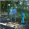
Old drinking fountain
This one, beside one of the entrances of King's Park, is C-listed. It has a ram's head carved at the top. The plaque beside it provides information about all four fountains. Reckoning from north to south, this is the second of them.
Image: © Lairich Rig
Taken: 21 Sep 2019
0.13 miles