
IMAGES TAKEN NEAR TO
St. Ninians Road, STIRLING, FK8 2HW
Introduction
This page details the photographs taken nearby to St. Ninians Road, FK8 2HW by members of the Geograph project.
The Geograph project started in 2005 with the aim of publishing, organising and preserving representative images for every square kilometre of Great Britain, Ireland and the Isle of Man.

There are currently over 7.5m images from over14,400 individuals and you can help contribute to the project by visiting https://www.geograph.org.uk
Image Map
Images are licensed for reuse under creativecommons.org/licenses/by-sa/2.0
Notes
- Clicking on the map will re-center to the selected point.
- The higher the marker number, the further away the image location is from the centre of the postcode.
Image Listing (12 Images Found)
Images are licensed for reuse under creativecommons.org/licenses/by-sa/2.0
Image
Details
Distance
1
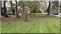
Randolph Stone, Stirling
One of two standing stones known locally as the Randolph Stones, supposedly marking the site of the first day of the battle of Bannockburn in 1314. However, recovered charcoal from the foundation cut of the stone was dated to 1283-1396, so there may be some basis to this!
Image: © Euan Nelson
Taken: 22 Oct 2019
0.03 miles
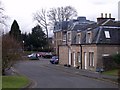
3
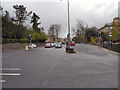
St Ninian's Road and Melville Terrace, Stirling
Image: © David Dixon
Taken: 18 Apr 2012
0.13 miles
4
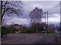
Stirling, street junction
Snowdon and Drummond Place.
Image: © Robert Murray
Taken: 20 Mar 2011
0.18 miles
5
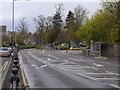
St Ninian's Road
St Ninian's Road in Stirling; the entrance to the council offices is on the right hand side.
Image: © David Dixon
Taken: 18 Apr 2012
0.20 miles
7
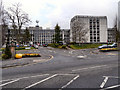
Stirling Council Offices
The Stirling Council office building on St Ninian's Road.
Image: © David Dixon
Taken: 18 Apr 2012
0.21 miles

9

Stirling Council Head Quarters
The Old Viewforth Building. This is where the Council Chambers are located.
Image: © G McK
Taken: 3 Mar 2006
0.22 miles
10
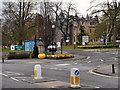
Stirling Council Offices Entrance
The entrance to the Stirling Council site on St Ninian's Road.
Image: © David Dixon
Taken: 18 Apr 2012
0.22 miles