
IMAGES TAKEN NEAR TO
Forthview, STIRLING, FK8 1TZ
Introduction
This page details the photographs taken nearby to Forthview, FK8 1TZ by members of the Geograph project.
The Geograph project started in 2005 with the aim of publishing, organising and preserving representative images for every square kilometre of Great Britain, Ireland and the Isle of Man.

There are currently over 7.5m images from over14,400 individuals and you can help contribute to the project by visiting https://www.geograph.org.uk
Image Map
Images are licensed for reuse under creativecommons.org/licenses/by-sa/2.0
Notes
- Clicking on the map will re-center to the selected point.
- The higher the marker number, the further away the image location is from the centre of the postcode.
Image Listing (103 Images Found)
Images are licensed for reuse under creativecommons.org/licenses/by-sa/2.0
Image
Details
Distance
1

Railway bridges over the River Forth
Although it appears to be a single bridge, there are in fact two railway bridges here, crossing the River Forth. The one nearest the camera carries the former North British Railway line, from Stirling to Alloa. Beyond this is the former Caledonian Railway line, running from Stirling to Perth.
Image: © Richard Sutcliffe
Taken: 18 May 2022
0.04 miles
2
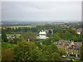
Stirling, River Forth
With part of Union Street and the rowing club pavilion on the banks of the river in the adjoining square.
Image: © Robert Murray
Taken: 11 Sep 2011
0.05 miles
3
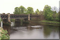
Railway bridge over the Forth at Stirling
Image: © Mike Pennington
Taken: 4 May 2009
0.05 miles
4
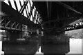
Railway Bridges over the River Forth, Lovers Walk, Stirling
Perth and Inverness to the north, Alloa to the East
Image: © Donald MacDonald
Taken: 31 Jan 2017
0.06 miles

6
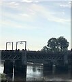
Railway bridge spanning the River Forth at Stirling
Image: © Eirian Evans
Taken: 8 Sep 2021
0.06 miles
7
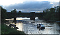
At anchor, River Forth, Riverside, Stirling
Although the Forth is tidal to the west side of Stirling, visiting boats rarely come so far upstream. Even more rare for them to anchor, as did this visitor from Grangemouth.
Image: © Donald MacDonald
Taken: 24 May 2007
0.06 miles
8

Roadworks beside the school
Looking down Forrest Road to Riverside Primary School and Nursery.
Image: © Richard Sutcliffe
Taken: 18 May 2022
0.08 miles
9
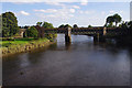
River Forth railway bridges
It's not immediately obvious that there are 2 parallel bridges here. The nearer upstream bridge carries the line from Stirling to Dunblane and Perth, which opened in 1848. The downstream bridge carries the line to Alloa, opened in 1852, closed in 1968 and re-opened in 2008. There are plans to electrify both of these lines.
Image: © Ian Taylor
Taken: 29 Sep 2013
0.08 miles
10
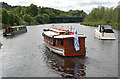
River Forth at Riverside, Stirling
Looking from the Stirling Rowing Club towards the railway bridge. Red Grouse, Ratho Princess, and a Rinker 250 in the foreground (L to R).
Image: © Donald MacDonald
Taken: 20 Jun 2009
0.09 miles