
IMAGES TAKEN NEAR TO
Ballengeich Road, STIRLING, FK8 1TN
Introduction
This page details the photographs taken nearby to Ballengeich Road, FK8 1TN by members of the Geograph project.
The Geograph project started in 2005 with the aim of publishing, organising and preserving representative images for every square kilometre of Great Britain, Ireland and the Isle of Man.

There are currently over 7.5m images from over14,400 individuals and you can help contribute to the project by visiting https://www.geograph.org.uk
Image Map
Images are licensed for reuse under creativecommons.org/licenses/by-sa/2.0
Notes
- Clicking on the map will re-center to the selected point.
- The higher the marker number, the further away the image location is from the centre of the postcode.
Image Listing (304 Images Found)
Images are licensed for reuse under creativecommons.org/licenses/by-sa/2.0
Image
Details
Distance
1
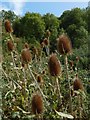
Teasels
Image: © Lairich Rig
Taken: 25 Aug 2018
0.05 miles
2
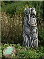
Sculpture: Teasels and Goldfinches
The sculpture is beside a path to Ballengeich Road; as with similar artwork nearby, no sculptor is named on the information panel. Some real teasels can be seen on the left: Image
See Image for a view of the artwork in context.
Image: © Lairich Rig
Taken: 25 Aug 2018
0.05 miles
3
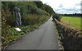
Path from Ballengeich Road
For the artwork on the left, see Image
An unusual grassy mound can be seen in the right background; it is Image
Image: © Lairich Rig
Taken: 25 Aug 2018
0.06 miles
4
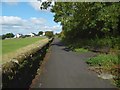
Path to Ballengeich Road
The path runs parallel to the Back Walk, which is further up the wooded slope to the right (east) of the path.
Image: © Lairich Rig
Taken: 25 Aug 2018
0.07 miles
5
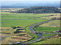
View from the ramparts of Stirling Castle
Looking north west from the Queen Anne Garden on the south side of the Palace.
Image: © kim traynor
Taken: 27 Nov 2011
0.07 miles
7
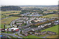
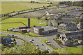
Raploch from Stirling Castle
The fire station is bottom left.
Image: © Mike Pennington
Taken: 17 Oct 2012
0.07 miles
8
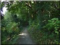
Path to Back o' Hill Road
The path begins beside Ballengeich Road and leads to Back o' Hill Road and to the Raploch: Image
Image: © Lairich Rig
Taken: 25 Aug 2018
0.08 miles
9
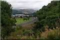
Back O'Hill Road, Stirling
Looking down from the lower end of Ballengeich Road. The new Sainsbury's superstore is ahead, as is the Wallace Monument.
Image: © Bill Boaden
Taken: 9 Aug 2013
0.08 miles
10
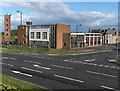
Fire station, Stirling
On the edge of the Raploch estate, at the junction of Raploch and Back o' Hill Roads.
Image: © Andrew Smith
Taken: 22 Jun 2006
0.09 miles