
IMAGES TAKEN NEAR TO
Bruce Street, STIRLING, FK8 1PB
Introduction
This page details the photographs taken nearby to Bruce Street, FK8 1PB by members of the Geograph project.
The Geograph project started in 2005 with the aim of publishing, organising and preserving representative images for every square kilometre of Great Britain, Ireland and the Isle of Man.

There are currently over 7.5m images from over14,400 individuals and you can help contribute to the project by visiting https://www.geograph.org.uk
Image Map
Images are licensed for reuse under creativecommons.org/licenses/by-sa/2.0
Notes
- Clicking on the map will re-center to the selected point.
- The higher the marker number, the further away the image location is from the centre of the postcode.
Image Listing (117 Images Found)
Images are licensed for reuse under creativecommons.org/licenses/by-sa/2.0
Image
Details
Distance
2
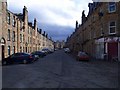
Stirling, Bruce Street
So near the castle that King Robert never managed to reduce. Still a fitting name for a street in this town.
Mostly populated by students as the abandoned trolleys from the supermarket at the end of the street testifies.
Image: © Robert Murray
Taken: 20 Mar 2011
0.02 miles
3
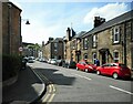
Douglas Street
From Wallace Street.
Image: © Richard Sutcliffe
Taken: 18 May 2022
0.06 miles
4
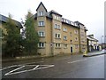
Stirling, Upper Bridge Street
University of Stirling flats.
Image: © Robert Murray
Taken: 11 Sep 2011
0.08 miles
6
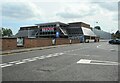
Tesco, Stirling
From the junction of Wallace Street and Douglas Street.
Image: © Richard Sutcliffe
Taken: 18 May 2022
0.10 miles
7

Lower Bridge Street, Stirling
Looking along Bridge Street towards Lower Bridge Street.
Image: © J G Harston
Taken: Unknown
0.10 miles
8
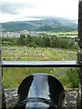
Stirling - Castle - Taking aim at the Wallace Monument
A canon peeps out of the battlements on the northeastern side of Stirling Castle pointing almost directly at the Wallace Monument on Abbey Craig a little under two miles away.
Image: © Rob Farrow
Taken: 2 Jul 2022
0.11 miles
9
Stirling, lane behind Upper Bridge Street
Been here for a while as it appears on the 1861 O.S. [Stirling Sht. X15]. No sign of a name but doubtless the locals have one for it.
Image: © Robert Murray
Taken: 11 Sep 2011
0.11 miles
10
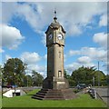
The Bridge Clock Tower
The tower is on the Customs Roundabout, from which the picture was also taken. According to an information panel nearby, the Bridge Clock Tower was gifted to the town by Provost David Bayne, who presided over its inauguration on Saturday the 17th of September, 1910.
As shown in the picture, there are underpasses here. Despite what appears on the dials, the time of day was the early afternoon.
Of the two inscribed panels that can be seen near the base of the tower, the sunlit one bears the Provost's initials and the year 1910: Image The other says "Bridge Clock Tower": Image It is so called because it is near Image
The tower was erected at the junction of Union Street and Wallace Street; it is still in more or less the same place, although later changes, such as the creation of the roundabout, required that it be moved slightly.
See Image for another contributor's view from a different angle.
Image: © Lairich Rig
Taken: 25 Aug 2018
0.12 miles