
IMAGES TAKEN NEAR TO
Cowane Street, STIRLING, FK8 1JP
Introduction
This page details the photographs taken nearby to Cowane Street, FK8 1JP by members of the Geograph project.
The Geograph project started in 2005 with the aim of publishing, organising and preserving representative images for every square kilometre of Great Britain, Ireland and the Isle of Man.

There are currently over 7.5m images from over14,400 individuals and you can help contribute to the project by visiting https://www.geograph.org.uk
Image Map
Images are licensed for reuse under creativecommons.org/licenses/by-sa/2.0
Notes
- Clicking on the map will re-center to the selected point.
- The higher the marker number, the further away the image location is from the centre of the postcode.
Image Listing (158 Images Found)
Images are licensed for reuse under creativecommons.org/licenses/by-sa/2.0
Image
Details
Distance
2
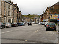
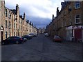
Douglas Street
From Wallace Street.
Image: © Richard Sutcliffe
Taken: 18 May 2022
0.06 miles
3
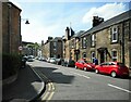
Stirling, Bruce Street
So near the castle that King Robert never managed to reduce. Still a fitting name for a street in this town.
Mostly populated by students as the abandoned trolleys from the supermarket at the end of the street testifies.
Image: © Robert Murray
Taken: 20 Mar 2011
0.08 miles
4
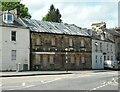
Empty and boarded up
21-23 Cowane Street (with adjoining buildings) is a Category C listed building http://portal.historicenvironment.scot/designation/LB41273. No. 21 had a ground floor shop. The building had become unsafe and from about 2014-2019 the property was covered in scaffolding and the walls stabilised. The original roof was removed and replaced, but although a temporary covering has been installed for some reason it has not yet been reslated. It is in the BARR website https://www.buildingsatrisk.org.uk/details/1009912.
Image: © Richard Sutcliffe
Taken: 18 May 2022
0.08 miles
5
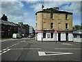
Pizza Hut
Previously a public house, now a Pizza Hut takeaway restaurant at the corner of Wallace Street and Cowane Street. Although the ground floor is in use, the upper floors have been empty for several years, and the building is in the BARR website https://www.buildingsatrisk.org.uk/details/1006122.
Image: © Richard Sutcliffe
Taken: 18 May 2022
0.09 miles
6
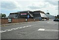
Tesco, Stirling
From the junction of Wallace Street and Douglas Street.
Image: © Richard Sutcliffe
Taken: 18 May 2022
0.10 miles
7
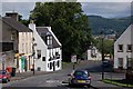
St Mary's Wynd
St Mary's Wynd is a continuation of Bow Street, this is where it runs downhill to become Upper Bridge Street. The white building on the left is The Settle Inn alleged to be the oldest public house in Stirling.
Image: © Paul McIlroy
Taken: 12 Aug 2007
0.10 miles
8
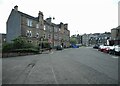
The end of Wallace Street
Approaching Goosecroft Road.
Image: © Richard Sutcliffe
Taken: 18 May 2022
0.10 miles
10
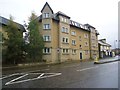
Stirling, Upper Bridge Street
University of Stirling flats.
Image: © Robert Murray
Taken: 11 Sep 2011
0.13 miles