
IMAGES TAKEN NEAR TO
Billy Bremner Way, STIRLING, FK8 1FS
Introduction
This page details the photographs taken nearby to Billy Bremner Way, FK8 1FS by members of the Geograph project.
The Geograph project started in 2005 with the aim of publishing, organising and preserving representative images for every square kilometre of Great Britain, Ireland and the Isle of Man.

There are currently over 7.5m images from over14,400 individuals and you can help contribute to the project by visiting https://www.geograph.org.uk
Image Map
Images are licensed for reuse under creativecommons.org/licenses/by-sa/2.0
Notes
- Clicking on the map will re-center to the selected point.
- The higher the marker number, the further away the image location is from the centre of the postcode.
Image Listing (9 Images Found)
Images are licensed for reuse under creativecommons.org/licenses/by-sa/2.0
Image
Details
Distance
1
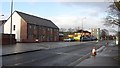
Drip Road
Raploch is now being redeveloped and there are a lot of new buildings here.
Image: © Richard Webb
Taken: 8 Mar 2012
0.09 miles
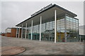
3
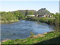
Bend on the River Forth at Stirling
Stirling Castle is prominent in the background.
Image: © G Laird
Taken: 6 May 2017
0.15 miles
4
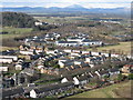
Raploch, and Castle Business Park
Looking over the housing estate, up the Forth Valley towards Ben Ledi, in the centre distance, 27km away.
Image: © M J Richardson
Taken: 23 Feb 2016
0.20 miles
5
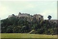
Stirling Castle
Stirling's history has been bloody and the castle on its crag is a stern redoubt. It stood in for Colditz in a 1970s TV series. The castle itself straddles two squares but is seen here from this square, looking east towards the crags.
Image: © Rosalind Mitchell
Taken: Unknown
0.21 miles
6
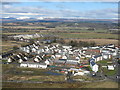
New housing at Raploch
Looking north from Stirling Castle. Forth Valley College is by the river at mid-left.
Image: © M J Richardson
Taken: 23 Feb 2016
0.22 miles
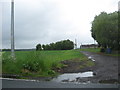
8
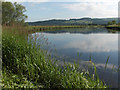
River Forth
Looking upstream from Kildean Market. Black Hill rises beyond Bridge of Allan.
Image: © Andrew Smith
Taken: 27 Jun 2006
0.24 miles
9
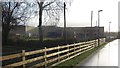
New building, Drip Road
Nearly completed building where there used to be a petrol station.
Image: © Richard Webb
Taken: 8 Mar 2012
0.24 miles