
IMAGES TAKEN NEAR TO
Glencoe Road, STIRLING, FK8 1ET
Introduction
This page details the photographs taken nearby to Glencoe Road, FK8 1ET by members of the Geograph project.
The Geograph project started in 2005 with the aim of publishing, organising and preserving representative images for every square kilometre of Great Britain, Ireland and the Isle of Man.

There are currently over 7.5m images from over14,400 individuals and you can help contribute to the project by visiting https://www.geograph.org.uk
Image Map
Images are licensed for reuse under creativecommons.org/licenses/by-sa/2.0
Notes
- Clicking on the map will re-center to the selected point.
- The higher the marker number, the further away the image location is from the centre of the postcode.
Image Listing (247 Images Found)
Images are licensed for reuse under creativecommons.org/licenses/by-sa/2.0
Image
Details
Distance
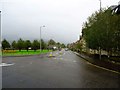
1

Lower Bridge Street, Stirling
Looking along Bridge Street towards Lower Bridge Street.
Image: © J G Harston
Taken: Unknown
0.05 miles
2
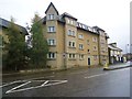
Stirling, Upper Bridge Street
University of Stirling flats.
Image: © Robert Murray
Taken: 11 Sep 2011
0.07 miles
3
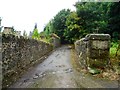
Stirling, lane behind Upper Bridge Street
Been here for a while as it appears on the 1861 O.S. [Stirling Sht. X15]. No sign of a name but doubtless the locals have one for it.
Image: © Robert Murray
Taken: 11 Sep 2011
0.08 miles
4
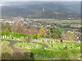
Gowanhill Cemetery
Looking across the cemetery from the 3-gun Battery at Stirling Castle, towards Stirling Bridge [just visible in the centre, between the dark green pine and yellow leaves to the left], and beyond to the Wallace Monument [2.45km away]. Because of the meanders in the River Forth the line of sight to the crag with the monument actually crosses the river three times.
Image: © M J Richardson
Taken: 31 Oct 2011
0.08 miles
5
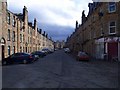
Stirling, Bruce Street
So near the castle that King Robert never managed to reduce. Still a fitting name for a street in this town.
Mostly populated by students as the abandoned trolleys from the supermarket at the end of the street testifies.
Image: © Robert Murray
Taken: 20 Mar 2011
0.09 miles
7
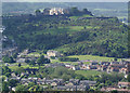
Stirling from the Wallace Monument
The castle overlooks the northern part of the town, with the bridge over the Forth just visible at the bottom left.
Image: © Mike Pennington
Taken: 10 Jun 2005
0.09 miles
8
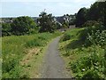
Path to Lower Bridge Street
The path leads down from Mote Hill and Gowan Hill; the farmhouse that was associated with the land on Gowan Hill (see Image) was near the entrance at the foot of this path.
Image: © Lairich Rig
Taken: 23 Jun 2018
0.10 miles
9
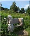
Wooden sculpture: Cruachan
The setting is the west side of the path that is shown in Image; the present picture was taken from about 30 metres further along that path.
The sculpture commemorates four Shetland Ponies, all named Cruachan, although distinguished as Cruachan I/II/III/IV. They were the mascots of, originally, the Argyll and Sutherland Highlanders and, latterly, the Royal Regiment of Scotland (which was formed by the amalgamation of the Argyll and Sutherland Highlanders with other regiments).
An information panel was set up here shortly after this picture was taken; it does not name the sculptor, but it does provide information about all four regimental mascots: for example, the first Cruachan was presented to the Argyll and Sutherland Highlanders in 1929; the most recent, Cruachan IV, was presented to the Royal Regiment of Scotland in 2012.
Image: © Lairich Rig
Taken: 23 Jun 2018
0.11 miles
10
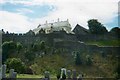
Stirling Castle
Known as the key to Scotland. Photograph taken from the cemetery just below the great fortress on Castle Rock. The light coloured building is the Great Hall.
Image: © James Denham
Taken: 4 Jul 1998
0.11 miles