
IMAGES TAKEN NEAR TO
Esplanade, STIRLING, FK8 1EH
Introduction
This page details the photographs taken nearby to Esplanade, FK8 1EH by members of the Geograph project.
The Geograph project started in 2005 with the aim of publishing, organising and preserving representative images for every square kilometre of Great Britain, Ireland and the Isle of Man.

There are currently over 7.5m images from over14,400 individuals and you can help contribute to the project by visiting https://www.geograph.org.uk
Image Map
Images are licensed for reuse under creativecommons.org/licenses/by-sa/2.0
Notes
- Clicking on the map will re-center to the selected point.
- The higher the marker number, the further away the image location is from the centre of the postcode.
Image Listing (524 Images Found)
Images are licensed for reuse under creativecommons.org/licenses/by-sa/2.0
Image
Details
Distance
1

Stirling in winter
A view towards the city of Stirling from high ground situated to the west of Dumyat. Much of the city can be seen in this image including Stirling Castle and the Wallace Monument, together with frost covered trees in Hermitage Wood in the foreground.
Image: © William Starkey
Taken: 2 Feb 2009
0.01 miles
2

Lower Square, Stirling Castle
From the Great Hall.
Image: © Andrew Abbott
Taken: 18 Aug 2020
0.01 miles
3

Stirling Castle
The final cannon at the far right end of the grand battery that protected the Ballengeich Pass
Image: © Michael Garlick
Taken: 6 Feb 2012
0.01 miles
4
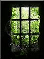
Stirling - Castle - Window at lowest level of Elphistone Tower
Elphistone Tower is situated at the southeastern corner of the main part of Stirling Castle. Steps descend to a partly subterranean level. This window looks out into the vegetation on the eastern side of the castle embankment.
Image: © Rob Farrow
Taken: 2 Jul 2022
0.01 miles
5

Traces of a tower from the reign of James IV
Traces of one of the semi-circular towers which protruded from the curtain wall of James IV's Forework, built to defend the castle in the 15th century.
Image: © kim traynor
Taken: 27 Nov 2011
0.01 miles
6

Looking through Stirling Castle Place window towards main courtyard
Image: © David Gearing
Taken: 4 Jul 2018
0.01 miles
7

The French Spur, Stirling Castle
A display notice informs the visitor that "Stirling Castle has the Auld Alliance with France to thank for this state-of-the-art artillery fortification. In the 1550s, the French king Henry II* invested more than 1 million pounds Scots and sent 6,000 troops to keep the English out of Scotland. His men probably built the spur some time after 1554." Its 11 guns guarded the castle entrance and the Old Bridge over the Forth; and the outside wall bears a fleur-de-lis carved by the French soldiers who built it.
*This is the unfortunate king who died in a jousting accident in 1559 when the lance of Montgomery, captain of his Scottish bodyguard, splintered and pierced Henry in one eye through his visor.
Image: © kim traynor
Taken: 27 Nov 2011
0.02 miles
8

The French Spur, Stirling Castle
The so-called French Spur was built in the reign of Mary of Guise who was Queen Regent in the middle of the 16th century. Projecting outwards from the main line of defence on the eastern side of the castle, it allowed the fire of defenders to sweep across the outer wall, and so was incorporated into the defences built later in the 18th century.
Image: © kim traynor
Taken: 27 Nov 2011
0.02 miles
9
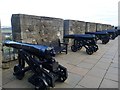
Cannons of the Grand Battery at Stirling Castle
Image: © Graham Hogg
Taken: 7 Nov 2016
0.02 miles
10

Stirling Castle Gatehouse tower
A side view of the eastern tower. As a result of the Scots proclaiming Charles II as their lawful king (r.1649-51; 1660-85), Cromwell's forces led by General Monck besieged the castle for three days in 1651 until its garrison mutinied and surrendered. Damage from the bombardment of that time can still be seen on the Gatehouse. The castle was subsequently garrisoned by Commonwealth troops until the Restoration of Charles in 1660.
Image: © kim traynor
Taken: 27 Nov 2011
0.02 miles