
IMAGES TAKEN NEAR TO
Spittal Street, STIRLING, FK8 1DU
Introduction
This page details the photographs taken nearby to Spittal Street, FK8 1DU by members of the Geograph project.
The Geograph project started in 2005 with the aim of publishing, organising and preserving representative images for every square kilometre of Great Britain, Ireland and the Isle of Man.

There are currently over 7.5m images from over14,400 individuals and you can help contribute to the project by visiting https://www.geograph.org.uk
Image Map
Images are licensed for reuse under creativecommons.org/licenses/by-sa/2.0
Notes
- Clicking on the map will re-center to the selected point.
- The higher the marker number, the further away the image location is from the centre of the postcode.
Image Listing (636 Images Found)
Images are licensed for reuse under creativecommons.org/licenses/by-sa/2.0
Image
Details
Distance
1
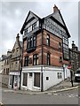
Sterlini Opidum
'STERLINI OPIDUM', 'THE STIRLING ARMS' inscribed on plaque with small animal on top. The tenement makes a colourful and effective pivotal statement at this significant road furniture and demonstrates Stirling's later period of fluition.
John Allan, 1890. 4-storey, 2-bay, old English style corner tenement, incorporating shop at ground, on site falling to N and E. Welsh urban brick work with polychromatic banding at 1st and 2nd floors, half- timbered gable, painted render at ground.
Category B listed. Listing number LB41090.
Image: © Andrew Abbott
Taken: 18 Aug 2020
0.01 miles
2
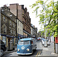
Baker Street
A foreign registered VW van near the bottom of the street.
Image: © Thomas Nugent
Taken: 20 Jun 2015
0.01 miles
4
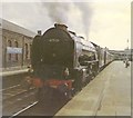
Departure for Glasgow
A former LNER pacific leaves Stirling with an Aberdeen train, bound for Glasgow Buchanan Street
Image: © Roger Cornfoot
Taken: Unknown
0.01 miles
5
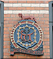
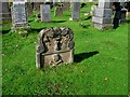
Plaque on The Stirling Arms
The plaque is on the Baker Street side of the Category B Listed http://data.historic-scotland.gov.uk/pls/htmldb/f?p=2200:15:0::::BUILDING:41090 Stirling Arms building. It is inscribed "TERLINI OPIDUM" and "THE STIRLING ARMS", with a small (mythological?) animal on top.
See also Image & Image
Image: © Thomas Nugent
Taken: 20 Jun 2015
0.01 miles
6
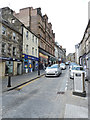
Baker Street
Looking up the hill near Dalgleish Court
Image: © Thomas Nugent
Taken: 20 Jun 2015
0.02 miles
7
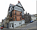
The Stirling Arms
A Category B Listed building http://data.historic-scotland.gov.uk/pls/htmldb/f?p=2200:15:0::::BUILDING:41090 on Baker Street at Bank Street (on right).
See also Image & Image
Image: © Thomas Nugent
Taken: 20 Jun 2015
0.02 miles
8
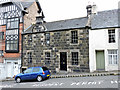
Bank Street
A short street, with a lot of character. This building is Category C Listed http://data.historic-scotland.gov.uk/pls/htmldb/f?p=2200:15:0::::BUILDING:41226 .
Image: © Thomas Nugent
Taken: 20 Jun 2015
0.02 miles
9
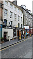
Nicky-Tams
A bar & bothy on Baker Street.
See also Image
Image: © Thomas Nugent
Taken: 20 Jun 2015
0.02 miles
10
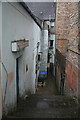
Sma'Vennel, Stirling
Connecting Spittal Street with Baker Street.
Image: © Dan
Taken: 4 Feb 2009
0.02 miles