IMAGES TAKEN NEAR TO
Baker Street, STIRLING, FK8 1BJ

Introduction

This page details the photographs taken nearby to Baker Street, FK8 1BJ by members of the Geograph project.

The Geograph project started in 2005 with the aim of publishing, organising and preserving representative images for every square kilometre of Great Britain, Ireland and the Isle of Man.

There are currently over 7.5m images from over14,400 individuals and you can help contribute to the project by visiting https://www.geograph.org.uk

Image Map


Images are licensed for reuse under creativecommons.org/licenses/by-sa/2.0
Notes
  • Clicking on the map will re-center to the selected point.
  • The higher the marker number, the further away the image location is from the centre of the postcode.

Image Listing (622 Images Found)

Images are licensed for reuse under creativecommons.org/licenses/by-sa/2.0
  • ...
Image
Details
Distance
1
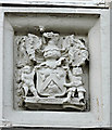
Old coat of arms
On the front of Nicky-Tams Bar & Bothy on Baker Street Image
Image: © Thomas Nugent Taken: 20 Jun 2015
0.01 miles
2
One of Stirling's old vennels
A plaque, out of shot to the photographer's right, relates that the surviving Stirling vennels run, as in this case, between Spittal Street (at this end) and Baker Street. Known locally as vennels, pends or closes, they provided a way between the tightly-packed buildings of the medieval town, or access to the backs or yards of properties.
Image: © Lairich Rig Taken: 21 Sep 2019
0.01 miles
3
Nicky-Tams
A bar & bothy on Baker Street. See also Image
Image: © Thomas Nugent Taken: 20 Jun 2015
0.01 miles
4
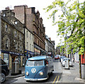
Baker Street
A foreign registered VW van near the bottom of the street.
Image: © Thomas Nugent Taken: 20 Jun 2015
0.02 miles
5
Holy Rude Cemetery
Image: © Chuck Schubert Taken: 22 Sep 2005
0.02 miles
6
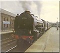
Departure for Glasgow
A former LNER pacific leaves Stirling with an Aberdeen train, bound for Glasgow Buchanan Street
Image: © Roger Cornfoot Taken: Unknown
0.02 miles
7
Mint Cafe and Patisserie
Image: © Oast House Archive Taken: 4 Aug 2019
0.02 miles
8
Baker Street
Looking up the hill near Dalgleish Court
Image: © Thomas Nugent Taken: 20 Jun 2015
0.02 miles
9
Baker Street
Looking down the hill from Bank Street.
Image: © Thomas Nugent Taken: 20 Jun 2015
0.02 miles
10
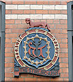
Plaque on The Stirling Arms
The plaque is on the Baker Street side of the Category B Listed http://data.historic-scotland.gov.uk/pls/htmldb/f?p=2200:15:0::::BUILDING:41090 Stirling Arms building. It is inscribed "TERLINI OPIDUM" and "THE STIRLING ARMS", with a small (mythological?) animal on top. See also Image & Image
Image: © Thomas Nugent Taken: 20 Jun 2015
0.03 miles
  • ...