
IMAGES TAKEN NEAR TO
Woolcarder's Court, STIRLING, FK7 9RA
Introduction
This page details the photographs taken nearby to Woolcarder's Court, FK7 9RA by members of the Geograph project.
The Geograph project started in 2005 with the aim of publishing, organising and preserving representative images for every square kilometre of Great Britain, Ireland and the Isle of Man.

There are currently over 7.5m images from over14,400 individuals and you can help contribute to the project by visiting https://www.geograph.org.uk
Image Map
Images are licensed for reuse under creativecommons.org/licenses/by-sa/2.0
Notes
- Clicking on the map will re-center to the selected point.
- The higher the marker number, the further away the image location is from the centre of the postcode.
Image Listing (20 Images Found)
Images are licensed for reuse under creativecommons.org/licenses/by-sa/2.0
Image
Details
Distance
1

Heyford Mill
The former mill buildings have been converted into flats and houses. This is the north west facing side of the largest building on the site, and has a residents car park in front of it. The road is now named Woolcarders Court.
Image: © Richard Dorrell
Taken: 14 Nov 2015
0.01 miles
2
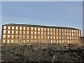
Hayford Mill
This is the south-east facing side of the largest of the buildings in the former mill. The building is now converted into private apartments, and is named Woolcarders Court.
Image: © Richard Dorrell
Taken: 14 Nov 2015
0.02 miles
3
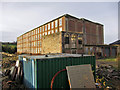
Heyford Mill, Engine House
Without trespassing, this is as close as it is currently possible to get to the ruinous Category A Listed engine house at Heyford Mill. The engine house is the 3-windowed building beyond the green shipping containers.
Conversion of the mill complex into flats and houses began in the year 2000, but in spite of its historical significance, this building has been allowed to deteriorate into its current roofless and windowless state. There is planning permission granted for conversion of the building into housing, so the outer walls of the building may yet be saved.
Image: © Richard Dorrell
Taken: 14 Nov 2015
0.02 miles
4
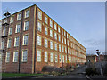
Heyford Mill
This, the largest building on the site, took a lot of bricks to build. The brickwork is more decorative on some of the other buildings, but the bonds used on this building still bear closer examination.
This building has now been converted into flats.
Image: © Richard Dorrell
Taken: 14 Nov 2015
0.03 miles
5

Derelict ground at Hayford Mill
Although most of the Mill buildings have now been converted into housing, a large area of land close-by remains derelict. The small square building left of centre is the Category A Listed former engine house, which is currently ruinous.
Image: © Richard Dorrell
Taken: 14 Nov 2015
0.03 miles
6
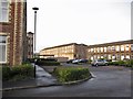
Heyford Mill
Conversion of the former mill complex into an estate of houses and flats is almost complete.
Image: © Richard Dorrell
Taken: 14 Nov 2015
0.05 miles
7
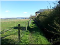
Footpath
The start of a short footpath tracing the route of the Raploch Burn to the A811.
Image: © Callum Black
Taken: 21 Apr 2016
0.06 miles
8
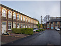
Heyford Mill
Conversion of the former mill buildings into flats and houses began in 2000. Some modern blocks (as seen on the right here) have also been built on the site.
Image: © Richard Dorrell
Taken: 14 Nov 2015
0.06 miles
9
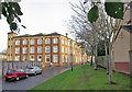
Heyford Mill
The former mill buildings have been converted into flats and houses. The road pictured here now has the name Hayford Mill.
Image: © Richard Dorrell
Taken: 14 Nov 2015
0.06 miles
10
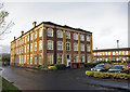
Heyford Mill
The former mill buildings have been converted into flats and houses. This particular building features rather more elaborate brickwork patterns than the other buildings on the site.
Image: © Richard Dorrell
Taken: 14 Nov 2015
0.08 miles