
IMAGES TAKEN NEAR TO
Broomhill Place, STIRLING, FK7 9LY
Introduction
This page details the photographs taken nearby to Broomhill Place, FK7 9LY by members of the Geograph project.
The Geograph project started in 2005 with the aim of publishing, organising and preserving representative images for every square kilometre of Great Britain, Ireland and the Isle of Man.

There are currently over 7.5m images from over14,400 individuals and you can help contribute to the project by visiting https://www.geograph.org.uk
Image Map
Images are licensed for reuse under creativecommons.org/licenses/by-sa/2.0
Notes
- Clicking on the map will re-center to the selected point.
- The higher the marker number, the further away the image location is from the centre of the postcode.
Image Listing (37 Images Found)
Images are licensed for reuse under creativecommons.org/licenses/by-sa/2.0
Image
Details
Distance
1
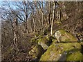
Steep rocky slope above a path
The path is shown in Image For a view in the opposite direction from further up the slope, see Image
Image: © Lairich Rig
Taken: 24 Feb 2018
0.04 miles
2
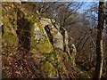
Steep rocky slope above a path
The path itself is shown in Image Some of the steep slopes to its northeast have exposed rock outcrops, like these; see Image for a view in the opposite direction. Others do not: Image
Image: © Lairich Rig
Taken: 24 Feb 2018
0.05 miles
3
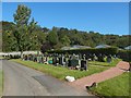
St Thomas Cemetery
The houses in the right background are on St Thomas's Place; the name is shown as such on large-scale mapping, and that spelling is confirmed by a street sign. However, the name of the cemetery itself is, according to the sign at its entrance, "St Thomas Cemetery", and the same form is employed on the information panel mentioned in the end-note. Some large-scale mapping uses the spelling "St Thomas's Cemetery", but that seems not to reflect actual usage.
Image: © Lairich Rig
Taken: 21 Sep 2019
0.06 miles
4
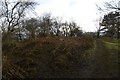
Highest point, King's Park
Between a golf course and crag.
Image: © Richard Webb
Taken: 1 Feb 2017
0.09 miles
5
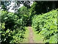
King's Park perimeter path
Path running around the south edge of King's Park at the foot of the hill.
Image: © Callum Black
Taken: 8 Jul 2016
0.09 miles
6
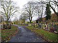
St Thomas Cemetery, Cambusbarron
A view north from within the large Burgh of Stirling cemetery. Cemetery entrance: Image
Image: © Richard Dorrell
Taken: 14 Nov 2015
0.10 miles
7
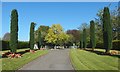
The entrance of St Thomas Cemetery
Not far ahead, just to the right of the path, is a drinking fountain (Image); the information panel mentioned in the end-note is beside it.
See Image for an earlier view of the entrance from a different angle.
Image: © Lairich Rig
Taken: 21 Sep 2019
0.11 miles
8
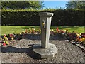
Drinking fountain, St Thomas Cemetery
The information panel mentioned in the end-note is nearby. The angle of view was chosen to conceal a plastic milk container just behind the fountain.
Because of the setting, I was reminded of the fountain in Image, though the shape is quite different.
Image: © Lairich Rig
Taken: 21 Sep 2019
0.11 miles
9
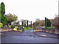
St Thomas Cemetery, Cambusbarron
Seen here from its entrance from Douglas Terrace. The site has been a burial ground for the Burgh of Stirling since 1949. The cemetery is recognised as having fourteen Commonwealth war graves.
Image: © Richard Dorrell
Taken: 14 Nov 2015
0.11 miles
10
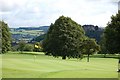
Golf course
This is the eighth green at King's Park Golf Course Stirling.
Image: © Paul McIlroy
Taken: 12 Aug 2007
0.11 miles