IMAGES TAKEN NEAR TO
FK7 9EX
Introduction
This page details the photographs taken nearby to FK7 9EX by members of the Geograph project.
The Geograph project started in 2005 with the aim of publishing, organising and preserving representative images for every square kilometre of Great Britain, Ireland and the Isle of Man.

There are currently over 7.5m images from over14,400 individuals and you can help contribute to the project by visiting https://www.geograph.org.uk
Image Map
Images are licensed for reuse under creativecommons.org/licenses/by-sa/2.0
Notes
- Clicking on the map will re-center to the selected point.
- The higher the marker number, the further away the image location is from the centre of the postcode.
Image Listing (12 Images Found)
Images are licensed for reuse under creativecommons.org/licenses/by-sa/2.0
Image
Details
Distance
2
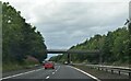
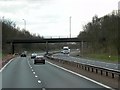
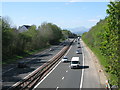
Stirling : The M9
Heading along the M9 Motorway.
Image: © Lewis Clarke
Taken: 25 Apr 2016
0.12 miles
3
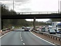
Polmaise Road Bridge over Southbound M9
Bridge linking Torbrex Road and St Ninians Road across the M9.
Image: © David Dixon
Taken: 28 Mar 2014
0.12 miles
4
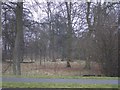
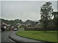
Woodland strip
By the main road through Torbrex.
Image: © Callum Black
Taken: 24 Mar 2006
0.12 miles
6
Stirling : The M9
Heading along the M9 Motorway.
Image: © Lewis Clarke
Taken: 25 Apr 2016
0.20 miles
8

Track at Bearside
Track leaving the Polmaise Road to the west at Bearside.
Image: © Callum Black
Taken: 24 Mar 2006
0.20 miles
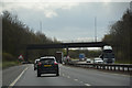
9
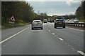
M9 at Stirling
The mountain in the far distance is Stùc a'Chroin, the junior neighbour of Ben Vorlich (Loch Earn) by 10 metres which would be to the right of Stùc a'Chroin but is hidden by the trees.
Image: © G Laird
Taken: 6 May 2017
0.21 miles