
IMAGES TAKEN NEAR TO
Myreton Drive, STIRLING, FK7 8PX
Introduction
This page details the photographs taken nearby to Myreton Drive, FK7 8PX by members of the Geograph project.
The Geograph project started in 2005 with the aim of publishing, organising and preserving representative images for every square kilometre of Great Britain, Ireland and the Isle of Man.

There are currently over 7.5m images from over14,400 individuals and you can help contribute to the project by visiting https://www.geograph.org.uk
Image Map
Images are licensed for reuse under creativecommons.org/licenses/by-sa/2.0
Notes
- Clicking on the map will re-center to the selected point.
- The higher the marker number, the further away the image location is from the centre of the postcode.
Image Listing (10 Images Found)
Images are licensed for reuse under creativecommons.org/licenses/by-sa/2.0
Image
Details
Distance
1
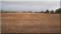
Stubble, Bannockburn
Very waterlogged field on another day of heavy rain. The field is inside a bypass and can be expected to be built upon one day.
Image: © Richard Webb
Taken: 31 Jan 2013
0.16 miles
2
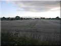
Stubble, Muir of Bannockburn
The last field before urban Stirling, so an obvious development target.
Image: © Richard Webb
Taken: 12 Sep 2018
0.17 miles
3
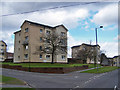
Flats in Fairgreen Place, Bannockburn
There are several smart blocks of flats in this south eastern corner of the town, just off the Falkirk Road.
Image: © Richard Dorrell
Taken: 3 Apr 2010
0.19 miles
4
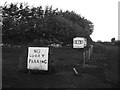
Car park, Corbiewood Stadium, Stirling
Nothing parked at the moment save for a derelict caravan.
Image: © Richard Webb
Taken: 12 Sep 2018
0.20 miles
5
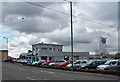
Newmarket Garage, Bannockburn
Located in Falkirk Road. The garage is a Škoda dealership.
Image: © Richard Dorrell
Taken: 3 Apr 2010
0.21 miles
6
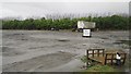
Car park, Corbiewood Stadium
Pallets are still wanted: Image but lorries are not welcome now.
Image: © Richard Webb
Taken: 31 Jan 2013
0.22 miles
8
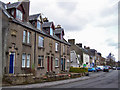
Newmarket, Bannockburn
This is the southern side of the road. The houses on the left are named Muirhead Terrace, and dated 1929. (See Image). The white buildings are shops. Beyond is a further un-named terrace of bay-fronted houses dated 1931.
Image: © Richard Dorrell
Taken: 3 Apr 2010
0.23 miles
9
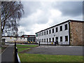
Bannockburn Primary School
Located in Quakerfield, a school for three to eleven year olds. Bannockburn Primary School was built in 1965 and has 18 rooms. An extension to the main building was completed in November 1993. This accommodates 5 infant classes. At present there are 17 classes in the school. The school is owned and maintained by Stirling Council.
Image: © Richard Dorrell
Taken: 3 Apr 2010
0.25 miles
10
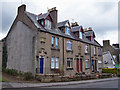
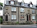
Muirhead Terrace, Newmarket, Bannockburn
A small terrace, dated 1929, standing at the south eastern end of Newmarket. The left gable end clearly shows that another building once stood against the surviving wall. The end-but-one doorway on the right is an open passage to the rear of the building.
Image: © Richard Dorrell
Taken: 3 Apr 2010
0.25 miles