
IMAGES TAKEN NEAR TO
Main Street, STIRLING, FK7 8LY
Introduction
This page details the photographs taken nearby to Main Street, FK7 8LY by members of the Geograph project.
The Geograph project started in 2005 with the aim of publishing, organising and preserving representative images for every square kilometre of Great Britain, Ireland and the Isle of Man.

There are currently over 7.5m images from over14,400 individuals and you can help contribute to the project by visiting https://www.geograph.org.uk
Image Map
Images are licensed for reuse under creativecommons.org/licenses/by-sa/2.0
Notes
- Clicking on the map will re-center to the selected point.
- The higher the marker number, the further away the image location is from the centre of the postcode.
Image Listing (51 Images Found)
Images are licensed for reuse under creativecommons.org/licenses/by-sa/2.0
Image
Details
Distance
1
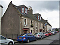
The Tartan Arms, Main Street
This public house has a long frontage onto Main Street, Bannockburn.
Image: © Richard Dorrell
Taken: 3 Apr 2010
0.01 miles
2
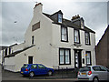
The Bannockburn Arms, Main Street
The building stands in the centre of this small town on the corner of West Murrayfield. There are function rooms to the rear. The business is currently for sale.
Image: © Richard Dorrell
Taken: 3 Apr 2010
0.01 miles
3
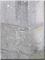
Ordnance Survey Cut Mark
This OS cut mark can be found on the SW angle of Murrayfield UF Church. It marks a point 39.554m above mean sea level.
Image: © Adrian Dust
Taken: 12 Apr 2016
0.02 miles
4
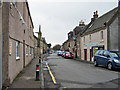
Main Street, Bannockburn
This road and the old town bridge to which it leads (behind the photographer) were by-passed by the building of New Road and a new bridge over the Bannock Burn in 1819 - which must be one of the earliest town centre by-passes ever built.
Image: © Richard Dorrell
Taken: 3 Apr 2010
0.02 miles
5
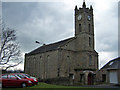
Murrayfield United Free Church, Bannockburn
One of several places of worship in or near the centre of Bannockburn. The Church building was originally Ladywell Free Church, but when the union of the disrupted Churches took place in 1929, the building deeds were invested with the Church of Scotland. In the 1950s the building was sold to Murrayfield United Free Church.
Image: © Richard Dorrell
Taken: 3 Apr 2010
0.03 miles
6
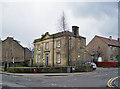
Council Offices, Bannockburn
Built 1850 as a school house for James Wilson of Bannockburn Mill. In 1886 the school ceased to be private, and closed in 1899. School buildings to the rear were demolished in 1986 when the building was acquired by Stirling District Council. The building stands in Main Street at its junction with West Murrayfield in the centre of Bannockburn. It is currently the offices of the Community Services, Community Learning and Development Youth Team.
Image: © Richard Dorrell
Taken: 3 Apr 2010
0.03 miles
7
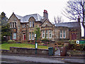
St Ninian's Parish Council Offices
Located in New Road, and dated 1908.
Image: © Richard Dorrell
Taken: 3 Apr 2010
0.03 miles
8
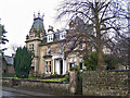
View Vale, New Road, Bannockburn
A substantial house built c.1880. Listed building description: http://hsewsf.sedsh.gov.uk/hslive/hsstart?P_HBNUM=15310
Image: © Richard Dorrell
Taken: 3 Apr 2010
0.03 miles
10
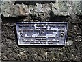
Bannockburn, Telford's bridge plaque
Self explanatory plaque commemorating the birthday of the great engineer.
Image: © Robert Murray
Taken: 28 May 2011
0.04 miles