IMAGES TAKEN NEAR TO
Chartershall, STIRLING, FK7 8HF
Introduction
This page details the photographs taken nearby to FK7 8HF by members of the Geograph project.
The Geograph project started in 2005 with the aim of publishing, organising and preserving representative images for every square kilometre of Great Britain, Ireland and the Isle of Man.

There are currently over 7.5m images from over14,400 individuals and you can help contribute to the project by visiting https://www.geograph.org.uk
Image Map
Images are licensed for reuse under creativecommons.org/licenses/by-sa/2.0
Notes
- Clicking on the map will re-center to the selected point.
- The higher the marker number, the further away the image location is from the centre of the postcode.
Image Listing (22 Images Found)
Images are licensed for reuse under creativecommons.org/licenses/by-sa/2.0
Image
Details
Distance
1
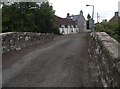
Old bridge at Chartershall
This old bridge over the Bannock Burn was originally constructed in 1696 and rebuilt in 1747. The white cottage just over the bridge was the old smithy and dates from the nineteenth century.
Image: © Euan Nelson
Taken: 7 Sep 2014
0.04 miles
2
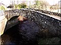
Bridge over the Bannock Burn, Chartershall
This single arch span bridge over the most famous burn in the land has an inscribed stone set within the parapet but the photographer was unable to decipher the mason's message though it undoubtedly contained the date of construction which the RCAHMS has dated as 1696 - rebuilt in 1847. The bridge is still in everyday use providing access to a dwelling house.
RCAHMS
http://canmore.rcahms.gov.uk/en/site/121656/details/chartershall+chartershall+road+old+bridge/
Image: © Robert Murray
Taken: 18 Jan 2010
0.04 miles
3
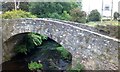
Bridge over the Bannock Burn at Chartershall
Image: © Euan Nelson
Taken: 2 Sep 2014
0.05 miles
4
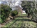
Mill lade at Chartershall
The lade is supplied by water from the Bannock Burn about 200m upstream at the weir locals call the 'Iron Falls' - on the west side of the M9.
Image: © Robert Murray
Taken: 18 Jan 2010
0.09 miles
5
Stirling, Fields at Chartershall
Looking over growing crops towards the line of trees that shields the Bannock Burn.
Image: © Robert Murray
Taken: 24 May 2011
0.13 miles
6
Bridge, Chartershall
The bridge over the M9 had been closed for some time. Work was about to start on the motorway at this location a few days later, an 8 month project, suggesting building a replacement.
Image: © Richard Webb
Taken: 15 Mar 2012
0.14 miles