
IMAGES TAKEN NEAR TO
Elgin Drive, STIRLING, FK7 7TZ
Introduction
This page details the photographs taken nearby to Elgin Drive, FK7 7TZ by members of the Geograph project.
The Geograph project started in 2005 with the aim of publishing, organising and preserving representative images for every square kilometre of Great Britain, Ireland and the Isle of Man.

There are currently over 7.5m images from over14,400 individuals and you can help contribute to the project by visiting https://www.geograph.org.uk
Image Map
Images are licensed for reuse under creativecommons.org/licenses/by-sa/2.0
Notes
- Clicking on the map will re-center to the selected point.
- The higher the marker number, the further away the image location is from the centre of the postcode.
Image Listing (14 Images Found)
Images are licensed for reuse under creativecommons.org/licenses/by-sa/2.0
Image
Details
Distance
2
Broomridge
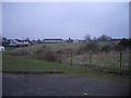
Open land in Stirling's eastern suburbs, now surrounded by new housing.
Image: © Callum Black
Taken: 24 Mar 2006
0.12 miles
3
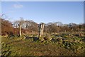
Fenceposts, Broomridge
A relic of the days when this was Broomridge Farm. Now mostly housing there is a big unused field between here and Bannockburn High School.
Image: © Richard Webb
Taken: 2 Feb 2018
0.13 miles
4
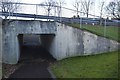
Subway, Broomridge
Under Broom Road, the main distribution road for Broomridge.
Image: © Richard Webb
Taken: 2 Feb 2018
0.14 miles
5
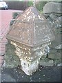
Old Milepost by the A9, Bannockburn Road, Bannockburn
Stirling BB casting by the A9, in parish of St Ninians (Stirling District), Bannockburn, near bus stop, nearly opposite school, Southwest side of road.
Inscription reads:-
: STIRLING / 2 / MILES : : FALKIRK / 9m / EDINBURGH / 38½m(?) :
Surveyed
Milestone Society National ID: ST_STFK02
Image: © Milestone Society
Taken: Unknown
0.14 miles
6
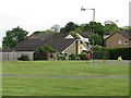
Shop off Broom Road
Broomridge, Stirling
Image: © Richard Webb
Taken: 15 May 2011
0.15 miles
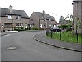
8
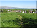
Broomridge, Stirling
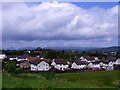
Looking down on Broomridge, an eastern suburb of Stirling from an open grassy area. The Ochil Hills are in the background.
Image: © G Laird
Taken: 6 May 2017
0.16 miles
9
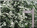
Footpath sign, Broomridge
Points to an open area and scrubby woodland.
Image: © Richard Webb
Taken: 15 May 2011
0.18 miles
10
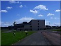
Bannockburn high School
See Image for another view.
Image: © Robert Murray
Taken: 28 May 2011
0.19 miles