
IMAGES TAKEN NEAR TO
Throsk, STIRLING, FK7 7NG
Introduction
This page details the photographs taken nearby to FK7 7NG by members of the Geograph project.
The Geograph project started in 2005 with the aim of publishing, organising and preserving representative images for every square kilometre of Great Britain, Ireland and the Isle of Man.

There are currently over 7.5m images from over14,400 individuals and you can help contribute to the project by visiting https://www.geograph.org.uk
Image Map
Images are licensed for reuse under creativecommons.org/licenses/by-sa/2.0
Notes
- Clicking on the map will re-center to the selected point.
- The higher the marker number, the further away the image location is from the centre of the postcode.
Image Listing (12 Images Found)
Images are licensed for reuse under creativecommons.org/licenses/by-sa/2.0
Image
Details
Distance
2
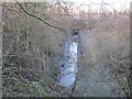
A tidal inlet, Poppletrees Bridge
A tidal inlet, out of sight from the Forth behind a high embankment.
Image: © Richard Webb
Taken: 5 Feb 2013
0.07 miles
3
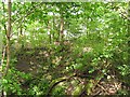
Embankment, Throsk
In woods beside the Forth, here there is an embankment a little like an old railway. Beyond the bank is the river and it is at high water.
Image: © Richard Webb
Taken: 18 May 2011
0.08 miles
4
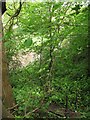
Woodland, Throsk
A steep wooded bank falls to a tidal inlet off the Forth. A 6m spring tide has flooded the tributary burn.
Image: © Richard Webb
Taken: 18 May 2011
0.08 miles
5
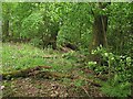
Woodland, Throsk
Woodland beside the Forth.
Image: © Richard Webb
Taken: 18 May 2011
0.08 miles
6
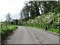
Old road alignment, Throsk
This redundant bend on the A905 has been left as a parking area. Usually these old bends are blocked off.
Image: © Richard Webb
Taken: 18 May 2011
0.12 miles
7
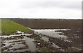
Arable land, Kersie
Carse land near the Forth after a wet night.
Image: © Richard Webb
Taken: 17 Apr 2012
0.14 miles
9
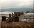
Old Forth Bridge
Remains of a disused railway bridge across the Forth. The railway between Throsk and Alloa was authorised in 1879 as a branch from the Caledonian Railway's South Alloa branch, the CR absorbed the line in 1884 and it was closed from 6 May 1968. This bridge, until the opening of the Forth Bridge at Queensferry, was the most downstream bridge on the Forth. Latterly it was a somewhat rickety affair with a 10mph speed restriction and was used by a shuttle service between Larbert and Alloa operated by a 4 wheel diesel railbus although, in earlier years, there had been through Glasgow - Perth services via the Devon Valley.
Image: © Gerald England
Taken: 28 Jun 1979
0.20 miles
10
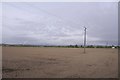
Newly cultivated land near Throsk
A lot of crops were late going in after a long cold spell during Spring.
Image: © Richard Webb
Taken: 9 May 2018
0.23 miles