
IMAGES TAKEN NEAR TO
Kersie Road, STIRLING, FK7 7NA
Introduction
This page details the photographs taken nearby to Kersie Road, FK7 7NA by members of the Geograph project.
The Geograph project started in 2005 with the aim of publishing, organising and preserving representative images for every square kilometre of Great Britain, Ireland and the Isle of Man.

There are currently over 7.5m images from over14,400 individuals and you can help contribute to the project by visiting https://www.geograph.org.uk
Image Map
Images are licensed for reuse under creativecommons.org/licenses/by-sa/2.0
Notes
- Clicking on the map will re-center to the selected point.
- The higher the marker number, the further away the image location is from the centre of the postcode.
Image Listing (10 Images Found)
Images are licensed for reuse under creativecommons.org/licenses/by-sa/2.0
Image
Details
Distance
2
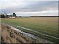
Stubble, Throsk
Carse land left under stubble for the Winter.
Image: © Richard Webb
Taken: 5 Feb 2013
0.03 miles
3
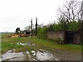
Old military buildings, Throsk
Although south of the A905, these are probably connected with the Royal Navy Depot at Throsk. One is used as a wheelybin store.
Image: © Richard Webb
Taken: 17 Apr 2012
0.13 miles
4
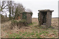
Brick structures
Perhaps someone can enlighten me with what these were? I presume they have something to do with the old RNAD munitions depot in Throsk, but these seem out of place.
Image: © Steve Somerville
Taken: 9 Mar 2022
0.15 miles
5
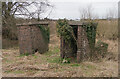
Brick structures
One of two photographs. Perhaps someone can tell me what these were. I presume they had something to do with the RNAD munitions depot in Throsk, but they still seem out of place.
Image: © Steve Somerville
Taken: 9 Mar 2022
0.16 miles
6
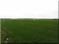
Carse land, Throsk
Flat arable land beside the Forth.
Image: © Richard Webb
Taken: 17 Apr 2012
0.19 miles
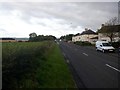
8
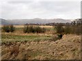
A burn under the A905
Arable carse land not far from the meandering Forth. The snow left the Ochil Hills very rapidly earlier in the week.
Image: © Richard Webb
Taken: 30 Jan 2013
0.21 miles
9
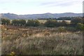
Rough ground, Burnbank
Uncultivated grass beside the A905 between Throsk and Fallin.
Image: © Richard Webb
Taken: 24 Sep 2018
0.22 miles
10
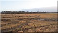
Waterlogged stubble
The field is a mess after prolonged heavy rain.
Image: © Richard Webb
Taken: 30 Jan 2013
0.24 miles