
IMAGES TAKEN NEAR TO
The Haven, STIRLING, FK7 7LB
Introduction
This page details the photographs taken nearby to The Haven, FK7 7LB by members of the Geograph project.
The Geograph project started in 2005 with the aim of publishing, organising and preserving representative images for every square kilometre of Great Britain, Ireland and the Isle of Man.

There are currently over 7.5m images from over14,400 individuals and you can help contribute to the project by visiting https://www.geograph.org.uk
Image Map
Images are licensed for reuse under creativecommons.org/licenses/by-sa/2.0
Notes
- Clicking on the map will re-center to the selected point.
- The higher the marker number, the further away the image location is from the centre of the postcode.
Image Listing (10 Images Found)
Images are licensed for reuse under creativecommons.org/licenses/by-sa/2.0
Image
Details
Distance
1
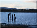
A ruined pier, South Alloa
The pier is still mapped but is looking distinctly ruined.
Image: © Richard Webb
Taken: 5 Feb 2013
0.07 miles
2
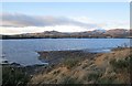
The Forth, South Alloa
Mud banks and a view over the Forth towards Alloa Inch and the Ochil Hills.
Image: © Richard Webb
Taken: 5 Feb 2013
0.09 miles
3
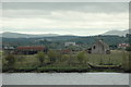
Alloa Inch
The farmhouse is now derelict and the water defences of this island have been breached so that it can flood during exceptionally high tides. (The bank in the foreground is not in this square, but the farm is!)
Image: © Gareth Foster
Taken: 20 Sep 2006
0.10 miles
4
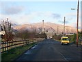
South Alloa
The road does not go as far as the industrial landscape, the River Forth is in the way. The hill is King's Seat Hill above Dollar.
Image: © Richard Webb
Taken: 5 Feb 2013
0.10 miles
5
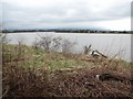
Shoreline, South Alloa
High tide on the Forth estuary with a view over to Alloa Inch.
Image: © Richard Webb
Taken: 1 Apr 2011
0.12 miles
6
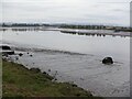
Forth estuary, South Alloa
No Luskentyrians were spotted packrafting in an inner tube. (I am reading Whit by Iain Banks at time of submission).
Image: © Richard Webb
Taken: 26 Apr 2021
0.13 miles
7
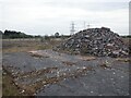
Themalite site, South Alloa
Demolished factory site, looks much as it did in 2017: Image
Image: © Richard Webb
Taken: 26 Apr 2021
0.14 miles
8
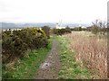
Embankment path, South Alloa
A path running along a coastal defence embankment beside the Forth.
Image: © Richard Webb
Taken: 1 Apr 2011
0.15 miles
9
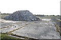
Demolished factory, South Alloa
The remains of the Thermalite factory in South Alloa, destined for housing.
Image: © Richard Webb
Taken: 17 May 2017
0.15 miles
10
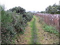
Footpath between the River Forth and Ferry Road at South Alloa
Looking north-eastward.
Image: © Peter Wood
Taken: 4 Oct 2017
0.16 miles