IMAGES TAKEN NEAR TO
Clark Street, STIRLING, FK7 0JW
Introduction
This page details the photographs taken nearby to Clark Street, FK7 0JW by members of the Geograph project.
The Geograph project started in 2005 with the aim of publishing, organising and preserving representative images for every square kilometre of Great Britain, Ireland and the Isle of Man.

There are currently over 7.5m images from over14,400 individuals and you can help contribute to the project by visiting https://www.geograph.org.uk
Image Map
Images are licensed for reuse under creativecommons.org/licenses/by-sa/2.0
Notes
- Clicking on the map will re-center to the selected point.
- The higher the marker number, the further away the image location is from the centre of the postcode.
Image Listing (8 Images Found)
Images are licensed for reuse under creativecommons.org/licenses/by-sa/2.0
Image
Details
Distance
4
Telephone box, Milton Brae
Bannockburn.
Image: © Richard Webb
Taken: 2 Feb 2018
0.22 miles
5
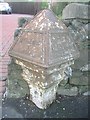
Old Milepost by the A9, Bannockburn Road, Bannockburn
Stirling BB casting by the A9, in parish of St Ninians (Stirling District), Bannockburn, near bus stop, nearly opposite school, Southwest side of road.
Inscription reads:-
: STIRLING / 2 / MILES : : FALKIRK / 9m / EDINBURGH / 38½m(?) :
Surveyed
Milestone Society National ID: ST_STFK02
Image: © Milestone Society
Taken: Unknown
0.22 miles
6
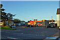
U-Save Convenience Store
Located in Gillespie Place, Whins of Milton.
Image: © Richard Dorrell
Taken: 26 Sep 2020
0.22 miles
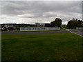
8
Vets, New Line road
Bruceview Veterinary Clinic, between Glasgow Road and New Line Road, Bannockburn.
Image: © Richard Webb
Taken: 15 May 2011
0.25 miles