
IMAGES TAKEN NEAR TO
Torwood, LARBERT, FK5 4SU
Introduction
This page details the photographs taken nearby to FK5 4SU by members of the Geograph project.
The Geograph project started in 2005 with the aim of publishing, organising and preserving representative images for every square kilometre of Great Britain, Ireland and the Isle of Man.

There are currently over 7.5m images from over14,400 individuals and you can help contribute to the project by visiting https://www.geograph.org.uk
Image Map
Images are licensed for reuse under creativecommons.org/licenses/by-sa/2.0
Notes
- Clicking on the map will re-center to the selected point.
- The higher the marker number, the further away the image location is from the centre of the postcode.
Image Listing (2 Images Found)
Images are licensed for reuse under creativecommons.org/licenses/by-sa/2.0
Image
Details
Distance
1
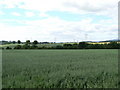
High Tension spider's web
The fields around Carbrook Mains Farm are under a latticework of electricity cables and pylons, running east-west and north-south too.
Image: © James Allan
Taken: 13 Jul 2006
0.02 miles
2
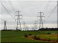
Pylonland
Notice the powerline going under the two parallel lines (from Longannet and Alloa).
A lot of electricity crossing arable land and a burn. The burn has run down from Plean Country Park - I would really appreciate a name from any locals reading.
Image: © Richard Webb
Taken: 11 Feb 2007
0.17 miles