
IMAGES TAKEN NEAR TO
LARBERT, FK5 4SH
Introduction
This page details the photographs taken nearby to FK5 4SH by members of the Geograph project.
The Geograph project started in 2005 with the aim of publishing, organising and preserving representative images for every square kilometre of Great Britain, Ireland and the Isle of Man.

There are currently over 7.5m images from over14,400 individuals and you can help contribute to the project by visiting https://www.geograph.org.uk
Image Map
Images are licensed for reuse under creativecommons.org/licenses/by-sa/2.0
Notes
- Clicking on the map will re-center to the selected point.
- The higher the marker number, the further away the image location is from the centre of the postcode.
Image Listing (6 Images Found)
Images are licensed for reuse under creativecommons.org/licenses/by-sa/2.0
Image
Details
Distance
1
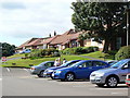
Glenbervie Golf Club Clubhouse
Taken from the car park.
Image: © James Allan
Taken: 13 Jul 2006
0.03 miles
2
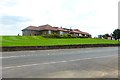
Glenbervie Golf Club
Aka the 'nineteenth hole'
Image: © Robert Murray
Taken: 1 Jul 2015
0.08 miles
3
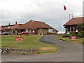
Glenbervie Golf Club
View of the club house from the A9.
Image: © Richard Webb
Taken: 23 Jun 2010
0.11 miles
4
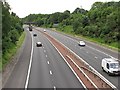
M876
Looking southwards from the A9 over bridge. This is short motorway linking the A80, soon to be the M80 with the Kincardine Bridge. It is unusual in that there are two sections with a shared bit of M9 between them. It is an important link with industry and the port in Grangemouth.
Image: © Richard Webb
Taken: 23 Jun 2010
0.19 miles
5
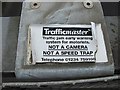
Please don't hit me
Sticker on a Trafficmaster motion detector on a motorway over bridge. These passive sensors check if traffic is moving without taking your number (which I like).
Image: © Richard Webb
Taken: 23 Jun 2010
0.21 miles
6
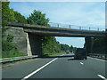
M876 passes under exit slip at Junction 2
Image: © Colin Pyle
Taken: 11 Jun 2015
0.23 miles