
IMAGES TAKEN NEAR TO
Stirling Road, LARBERT, FK5 4NE
Introduction
This page details the photographs taken nearby to Stirling Road, FK5 4NE by members of the Geograph project.
The Geograph project started in 2005 with the aim of publishing, organising and preserving representative images for every square kilometre of Great Britain, Ireland and the Isle of Man.

There are currently over 7.5m images from over14,400 individuals and you can help contribute to the project by visiting https://www.geograph.org.uk
Image Map
Images are licensed for reuse under creativecommons.org/licenses/by-sa/2.0
Notes
- Clicking on the map will re-center to the selected point.
- The higher the marker number, the further away the image location is from the centre of the postcode.
Image Listing (37 Images Found)
Images are licensed for reuse under creativecommons.org/licenses/by-sa/2.0
Image
Details
Distance
1
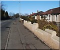
Stirling Road
The photograph was taken from a point just a few metres north of the junction of Stirling Road and Pretoria Road.
Image: © Lairich Rig
Taken: 1 Mar 2010
0.05 miles

4
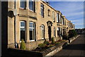
Pretoria Road, Larbert
Traditional sandstone housing in Larbert near Falkirk.
Image: © Colin Kinnear
Taken: 1 Nov 2010
0.12 miles
5
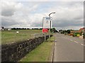
A9
The directions to the new hospital await being cleared off.
Image: © Richard Webb
Taken: 23 Jun 2010
0.14 miles
6
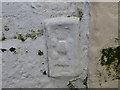
Ordnance Survey Flush Bracket S4569
This heavily over-painted bracket can be found on a roadside wall of the Commercial Hotel in Larbert. The benchmark height is recorded as being 31.577 metres above sea level. For more detail see : http://www.bench-marks.org.uk/bm19278
Image: © Peter Wood
Taken: 29 Sep 2017
0.17 miles
7

Larbert House Policies
Interesting ditch which runs in a north, south line about 50m from the eastern side of the ornamental lake. To the right is a recently made water feature. the mulch covering the ground is the result of clearing the huge infestation of rhododendron around the lake.
Image: © Robert Murray
Taken: 22 Apr 2011
0.17 miles
8
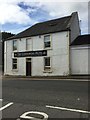
The Commercial Hotel, Larbert
Flush Bracket OSBM S4569 bottom right hand corner of main building
Image: © thejackrustles
Taken: 8 Sep 2019
0.17 miles
9
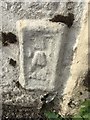
OS Flush Bracket OSBM S4569 - Larbert, Commercial Hotel
Ordnance Survey Flush Bracket OSBM S4569: Larbert, Commercial Hotel
Image: © thejackrustles
Taken: 8 Sep 2019
0.17 miles
10
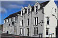
The Tea House Chinese Restaurant, Larbert Cross
Formerly The Red Lion Hotel
Image: © Leslie Barrie
Taken: 10 Oct 2013
0.18 miles