IMAGES TAKEN NEAR TO
BONNYBRIDGE, FK4 2EP
Introduction
This page details the photographs taken nearby to FK4 2EP by members of the Geograph project.
The Geograph project started in 2005 with the aim of publishing, organising and preserving representative images for every square kilometre of Great Britain, Ireland and the Isle of Man.

There are currently over 7.5m images from over14,400 individuals and you can help contribute to the project by visiting https://www.geograph.org.uk
Image Map
Images are licensed for reuse under creativecommons.org/licenses/by-sa/2.0
Notes
- Clicking on the map will re-center to the selected point.
- The higher the marker number, the further away the image location is from the centre of the postcode.
Image Listing (2 Images Found)
Images are licensed for reuse under creativecommons.org/licenses/by-sa/2.0
Image
Details
Distance
2
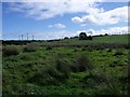
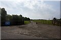
Bonnymuir
Site of a skirmish in 1820 between the Radicals and a troop of government hussars.
See also Image and Image Further information about 1820 can be had at http://cranntara.org.uk/bonny10.htm and http://bbc.co.uk/dna/h2g2/A1100601
Image: © Robert Murray
Taken: 18 Sep 2010
0.24 miles