
IMAGES TAKEN NEAR TO
Hawthorn Street, GRANGEMOUTH, FK3 8PX
Introduction
This page details the photographs taken nearby to Hawthorn Street, FK3 8PX by members of the Geograph project.
The Geograph project started in 2005 with the aim of publishing, organising and preserving representative images for every square kilometre of Great Britain, Ireland and the Isle of Man.

There are currently over 7.5m images from over14,400 individuals and you can help contribute to the project by visiting https://www.geograph.org.uk
Image Map
Images are licensed for reuse under creativecommons.org/licenses/by-sa/2.0
Notes
- Clicking on the map will re-center to the selected point.
- The higher the marker number, the further away the image location is from the centre of the postcode.
Image Listing (5 Images Found)
Images are licensed for reuse under creativecommons.org/licenses/by-sa/2.0
Image
Details
Distance
2
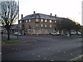
Shops, Newlands Road
Unlike many others who planned large housing estates those who designed Grangemouth scattered several small groups of shops amongst the houses.
Image: © Tom Sargent
Taken: 27 Dec 2008
0.15 miles
3
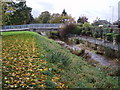
Grange Burn
Grange Burn at the south entrance to Zetland Park, Grangemouth.
This is the burn that gives Grangemouth its name, though the last few kilometres of the Grange Burn are now canalised so it enters the Forth at a different place from years ago. Grangemouth was originally called Sealock.
Image: © Adam Ward
Taken: 26 Oct 2006
0.23 miles
5
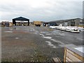
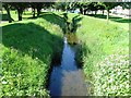
Woodyard at Grangemouth
A contrasting view from that in the other direction Image, and others of the Jupiter Urban Wildlife Centre, e.g. Image, showing what might have been without the intervention of the Scottish Wildlife Trust.
Image: © M J Richardson
Taken: 26 Jul 2009
0.24 miles