
IMAGES TAKEN NEAR TO
Langton Road, FALKIRK, FK2 9TA
Introduction
This page details the photographs taken nearby to Langton Road, FK2 9TA by members of the Geograph project.
The Geograph project started in 2005 with the aim of publishing, organising and preserving representative images for every square kilometre of Great Britain, Ireland and the Isle of Man.

There are currently over 7.5m images from over14,400 individuals and you can help contribute to the project by visiting https://www.geograph.org.uk
Image Map
Images are licensed for reuse under creativecommons.org/licenses/by-sa/2.0
Notes
- Clicking on the map will re-center to the selected point.
- The higher the marker number, the further away the image location is from the centre of the postcode.
Image Listing (17 Images Found)
Images are licensed for reuse under creativecommons.org/licenses/by-sa/2.0
Image
Details
Distance
1
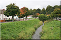
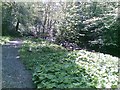
Westquarter Burn
The burn flows through what was once the grounds of Westquarter House, the seat of the Livingstons of Westquarter, who were connected to the Earls of Callander. Nothing survives of the house, but the pleasant wooded setting is now enjoyed by the occupants of Langton Road, on the right, and Park Crescent, on the left.
Image: © Anne Burgess
Taken: 5 Oct 2013
0.03 miles
2

Old Milepost by the A803, Polmont Road, Laurieston, Falkirk Parish
Stirling GM casting by the A803, in parish of Falkirk (Falkirk District), Laurieston, by wall, back of footpath near LP55, North side of road.
Surveyed
Milestone Society National ID: FK_FKLL01
Image: © Milestone Society
Taken: Unknown
0.13 miles
3
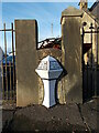
Old milepost
On the A803 between Falkirk and Linlithgow in Lauriston. This style of post was cast at the Grangemouth Foundry in the late 19C or early 20C. it has been repainted recently.
Image: © John Riddell
Taken: 10 Oct 2021
0.13 miles
5
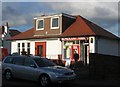
Bungalow shop.
Where Dick and Dom got theirs? Shop in Laurieston
Image: © Richard Webb
Taken: 26 Jan 2006
0.17 miles
6
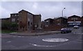
Laurieston War Memorial
An ordinary small town - but a long list of names.
Image: © Tom Sargent
Taken: 14 Apr 2009
0.18 miles
8
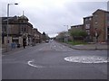
Central Laurieston
Looking east along the road to Edinburgh
Image: © Tom Sargent
Taken: 14 Apr 2009
0.20 miles
10
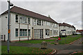
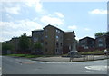
Westquarter School
The Art Deco building on the north side of Westquarter Avenue is still in use as a school.
Image: © Anne Burgess
Taken: 5 Oct 2013
0.21 miles