IMAGES TAKEN NEAR TO
Potter Place, FALKIRK, FK2 8NS
Introduction
This page details the photographs taken nearby to Potter Place, FK2 8NS by members of the Geograph project.
The Geograph project started in 2005 with the aim of publishing, organising and preserving representative images for every square kilometre of Great Britain, Ireland and the Isle of Man.

There are currently over 7.5m images from over14,400 individuals and you can help contribute to the project by visiting https://www.geograph.org.uk
Image Map
Images are licensed for reuse under creativecommons.org/licenses/by-sa/2.0
Notes
- Clicking on the map will re-center to the selected point.
- The higher the marker number, the further away the image location is from the centre of the postcode.
Image Listing (16 Images Found)
Images are licensed for reuse under creativecommons.org/licenses/by-sa/2.0
Image
Details
Distance
1
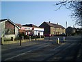
Main Street Skinflats
The Dutch workers who were brought over in the 1800s to reclaim land from the river Forth named this village "Beautiful Plains" in their own language. Alas the locals corrupted the pronunciation into one far from beautiful. There seems to be no local connection with leather working.
Image: © Tom Sargent
Taken: 16 Feb 2008
0.03 miles
2
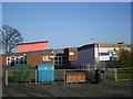
Bothkennar Primary School, Skinflats
With brightly painted buildings and cheerful drawings in the windows, this is a typical modern primary school building.
Image: © Tom Sargent
Taken: 16 Feb 2008
0.07 miles
3

Crop field east of Skinflats
The fields are big, big in this area. Good, flat well drained soil. And like most photos taken around here any north easterly aspect will contain (the soon to be historical) sight of Longannet power station across the river Forth.
Image: © Robert Murray
Taken: 1 Jul 2015
0.08 miles
4
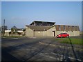
Dutch Inn, Skinflats
Marked on the map as a Public House (PH), the Inn has a dining room and other facilities.
Image: © Tom Sargent
Taken: 16 Feb 2008
0.10 miles
5
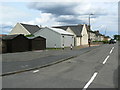
Skinflats
Newton Avenue in the village with the unlovely name of Skinflats.
Image: © James Allan
Taken: 8 Jul 2006
0.12 miles
6
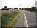
Approaching Skinflats
The A905 entering Skinflats across very flat and low lying farmland.
Image: © Richard Webb
Taken: 18 Sep 2009
0.13 miles
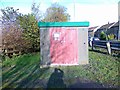
8
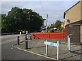
Junction of A905 and Newton Ave, Skinflats
Image: © John Lord
Taken: 25 Sep 2008
0.14 miles
9
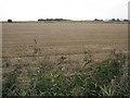
Stubble, Skinflats
Carse land beside the Carron.
Image: © Richard Webb
Taken: 18 Sep 2009
0.14 miles