
IMAGES TAKEN NEAR TO
Linn Place, FALKIRK, FK2 8JU
Introduction
This page details the photographs taken nearby to Linn Place, FK2 8JU by members of the Geograph project.
The Geograph project started in 2005 with the aim of publishing, organising and preserving representative images for every square kilometre of Great Britain, Ireland and the Isle of Man.

There are currently over 7.5m images from over14,400 individuals and you can help contribute to the project by visiting https://www.geograph.org.uk
Image Map
Images are licensed for reuse under creativecommons.org/licenses/by-sa/2.0
Notes
- Clicking on the map will re-center to the selected point.
- The higher the marker number, the further away the image location is from the centre of the postcode.
Image Listing (18 Images Found)
Images are licensed for reuse under creativecommons.org/licenses/by-sa/2.0
Image
Details
Distance
4
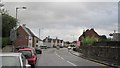
Main Street, Airth
The A905 seen from outside the village shop.
Image: © Richard Webb
Taken: 13 Sep 2012
0.16 miles
5
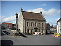
Airth High Street
An old building in the High Street beside the mercat cross.
Image: © Jim Smillie
Taken: 31 Mar 2009
0.16 miles
6

Airth mercat cross
Good to see a well tended cross for a change. Compare this with Kincardine's, only a few miles away but under a different council. Image
Image: © kim traynor
Taken: 20 Jun 2013
0.18 miles
7
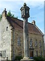
Airth mercat cross
Mercat crosses often incorporate sundials, though the pillar of the cross itself would have functioned as a primitive sundial in the days before timepieces were commonly available.
Image: © kim traynor
Taken: 20 Jun 2013
0.18 miles
8
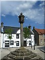
Airth mercat cross
One of the finest examples of a village cross.
Image: © kim traynor
Taken: 20 Jun 2013
0.18 miles
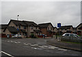
10

Old building, High Street
A building of probable 18th-century date on the way from the modern main road to the old centre of the village.
Image: © kim traynor
Taken: 20 Jun 2013
0.19 miles