
IMAGES TAKEN NEAR TO
Leny Road, CALLANDER, FK17 8AJ
Introduction
This page details the photographs taken nearby to Leny Road, FK17 8AJ by members of the Geograph project.
The Geograph project started in 2005 with the aim of publishing, organising and preserving representative images for every square kilometre of Great Britain, Ireland and the Isle of Man.

There are currently over 7.5m images from over14,400 individuals and you can help contribute to the project by visiting https://www.geograph.org.uk
Image Map
Images are licensed for reuse under creativecommons.org/licenses/by-sa/2.0
Notes
- Clicking on the map will re-center to the selected point.
- The higher the marker number, the further away the image location is from the centre of the postcode.
Image Listing (70 Images Found)
Images are licensed for reuse under creativecommons.org/licenses/by-sa/2.0
Image
Details
Distance
1
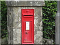
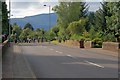
Victorian Wallbox in Callander
VR embossed wallbox on the north side of the A84 Leny Road at the western end of Callander.
Image: © Scott Cormie
Taken: 20 Aug 2018
0.01 miles
2
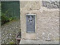
Ordnance Survey Flush Bracket S5179
This bracket can be found on the wall of a private dwelling in Leny Road (A84), Callander. The benchmark height is recorded as being 76.11 metres above sea level. For more detail see : http://www.bench-marks.org.uk/bm2577
Image: © Peter Wood
Taken: 2 Oct 2017
0.03 miles
3
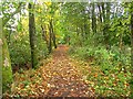
National Cycle Network route 7
A cycle and footpath heading towards a bridge over the River Teith. The path uses the route of the Dunblane, Doune and Callander Railway.
Image: © Richard Webb
Taken: 19 Oct 2010
0.05 miles
4
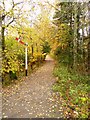
Signal by the footpath
A railway signal stands beside this cycle and footpath as a reminder that the path follows the track of the erstwhile Dunblane, Doune and Callander Railway.
Image: © James Allan
Taken: 5 Nov 2010
0.06 miles
6
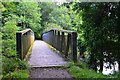
Footbridge over the Garbh Uisge, Callander
On the cyclepath along the former railway from Callander to Lochearnhead.
Image: © Jim Barton
Taken: 3 Sep 2015
0.08 miles
7
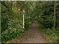
Cycleway
Situated at the northern side of the square this is the start of the Callander to Strathyre cycleway, a former railway line.
Image: © Paul McIlroy
Taken: 7 Oct 2005
0.09 miles
9
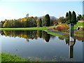
Reflect On This
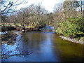
Flooded park land adjacent to the River side car park.
Image: © J Scott
Taken: 22 Oct 2005
0.12 miles
10
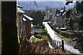
Path to the woodland, Callander
A way in from the car park to the Callander Craig and lower woodlands paths.
Image: © Jim Barton
Taken: 20 Feb 2015
0.12 miles