IMAGES TAKEN NEAR TO
Fir Road, DOUNE, FK16 6HU
Introduction
This page details the photographs taken nearby to Fir Road, FK16 6HU by members of the Geograph project.
The Geograph project started in 2005 with the aim of publishing, organising and preserving representative images for every square kilometre of Great Britain, Ireland and the Isle of Man.

There are currently over 7.5m images from over14,400 individuals and you can help contribute to the project by visiting https://www.geograph.org.uk
Image Map
Images are licensed for reuse under creativecommons.org/licenses/by-sa/2.0
Notes
- Clicking on the map will re-center to the selected point.
- The higher the marker number, the further away the image location is from the centre of the postcode.
Image Listing (47 Images Found)
Images are licensed for reuse under creativecommons.org/licenses/by-sa/2.0
Image
Details
Distance
1
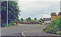
Site of Doune station, 1997
A totally uninteresting view eastward west of the village: Doune station had been on the Dunblane - Callander - Crianlarich section of the ex-Caledonian Glasgow - Stirling - Oban main line which was closed Dunblane - Crianlarich from 1/11/65.
Image: © Ben Brooksbank
Taken: 1 Jul 1997
0.07 miles
2
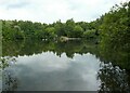
View across the pond
Looking out over the larger of the ponds at Doune Ponds.
The ponds are part of a local nature reserve located in an old sand and gravel quarry.
Image: © Richard Sutcliffe
Taken: 9 Jul 2021
0.13 miles
3
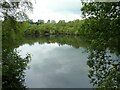
View from the hide
Looking out over the larger of the ponds at Doune Ponds from one of the hides Image
The ponds are part of a local nature reserve located in an old sand and gravel quarry.
Image: © Richard Sutcliffe
Taken: 9 Jul 2021
0.13 miles
4
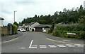
Pistol Makers Row, Doune
The name of the street is a nod to the history of Doune. Pistols were made in Doune from the 1640s and were renowned for their high quality. See https://doune.co/home/heritage/doune-pistols/.
Image: © Richard Sutcliffe
Taken: 9 Jul 2021
0.13 miles
5
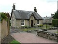
Station House
At the corner of Balkerach Street and Station Wynd. The house dates from about 1875 and was the station house for Doune Station, which was situated immediately to the north of the building. It was on the Dunblane, Doune and Callander Railway, which opened in 1858 and was initially operated by Scottish Central Railway. The line closed in 1965.
The house is Category C listed http://portal.historicenvironment.scot/designation/LB24658.
Image: © Richard Sutcliffe
Taken: 9 Jul 2021
0.14 miles
6
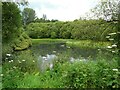
Pond, Doune Ponds
Looking out over the ponds at Doune Ponds from beside one of the hides.
The ponds are part of a local nature reserve located in an old sand and gravel quarry.
Image: © Richard Sutcliffe
Taken: 9 Jul 2021
0.14 miles
8
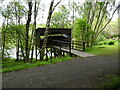
Hide beside the pond
One of the hides around the largest of the ponds at Doune Ponds.
The ponds are part of a local nature reserve located in an old sand and gravel quarry.
Image: © Richard Sutcliffe
Taken: 9 Jul 2021
0.15 miles
9
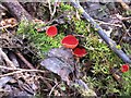
A scarlet cup fungus
Sarcoscypha austriaca, a striking and infrequent spring fungus that grows on sticks of deciduous trees, especially alder, willow and sycamore. These specimens were found in the Doune Ponds Nature Reserve.
Image: © M J Richardson
Taken: 4 Apr 2010
0.16 miles