
IMAGES TAKEN NEAR TO
Castle Crescent, DOUNE, FK16 6BX
Introduction
This page details the photographs taken nearby to Castle Crescent, FK16 6BX by members of the Geograph project.
The Geograph project started in 2005 with the aim of publishing, organising and preserving representative images for every square kilometre of Great Britain, Ireland and the Isle of Man.

There are currently over 7.5m images from over14,400 individuals and you can help contribute to the project by visiting https://www.geograph.org.uk
Image Map
Images are licensed for reuse under creativecommons.org/licenses/by-sa/2.0
Notes
- Clicking on the map will re-center to the selected point.
- The higher the marker number, the further away the image location is from the centre of the postcode.
Image Listing (144 Images Found)
Images are licensed for reuse under creativecommons.org/licenses/by-sa/2.0
Image
Details
Distance
1
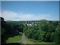
Doune
View of Doune from Doune Castle.
Image: © Darren Haddock
Taken: 12 Jul 2005
0.03 miles
2
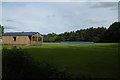
Cricket ground, Doune
The site of a Roman fort.
Image: © Richard Webb
Taken: 7 Jun 2017
0.07 miles
3
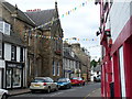
Main Street, Doune
This is the main road through the village. Note Harvey's Map Shop on the left which produces detailed and waterproof large scale maps of popular hiking areas.
Image: © Colin Smith
Taken: 12 Aug 2006
0.09 miles
4
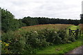
The site of the Roman fort, Doune
There isn't much to be seen.
Image: © Bill Boaden
Taken: 9 Aug 2013
0.10 miles
5

Main Street, Doune
Including the offices of Harvey Maps.
Image: © Richard Webb
Taken: 11 May 2025
0.11 miles
6
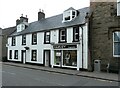
Harvey Mapmakers
On Main Street, Doune. Founded in 1977, Harvey specialises in publishing maps for outdoor recreation, created from original mapping.
The building is late 18th century and Category B listed http://portal.historicenvironment.scot/designation/LB24707.
Image: © Richard Sutcliffe
Taken: 9 Jul 2021
0.11 miles
7
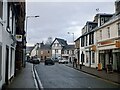
Main Street, Doune
Home of Harvey Maps
Image: © Richard Webb
Taken: 10 Dec 2022
0.11 miles
8
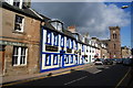
The Highland Hotel and Main Street, Doune
The church is no longer in use.
Image: © Bill Boaden
Taken: 9 Aug 2013
0.11 miles
9

Harvey Mapmakers, Doune
I thought this an appropriate geograph for this gridsquare and was sorry the shop was closed.
Image: © Becky Williamson
Taken: 15 May 2011
0.12 miles
10
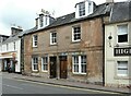
Former shops
This building (13-17 Main Street, Doune) was formerly two shop premises. The surviving names above the doors and windows read:
'CAMPBELL TAILOR & CLOTHIER' and 'D.A.CALDER'.
The building is Category C listed http://portal.historicenvironment.scot/designation/LB24689.
Image: © Richard Sutcliffe
Taken: 9 Jul 2021
0.12 miles