
IMAGES TAKEN NEAR TO
Main Street, DOUNE, FK16 6BW
Introduction
This page details the photographs taken nearby to Main Street, FK16 6BW by members of the Geograph project.
The Geograph project started in 2005 with the aim of publishing, organising and preserving representative images for every square kilometre of Great Britain, Ireland and the Isle of Man.

There are currently over 7.5m images from over14,400 individuals and you can help contribute to the project by visiting https://www.geograph.org.uk
Image Map
Images are licensed for reuse under creativecommons.org/licenses/by-sa/2.0
Notes
- Clicking on the map will re-center to the selected point.
- The higher the marker number, the further away the image location is from the centre of the postcode.
Image Listing (109 Images Found)
Images are licensed for reuse under creativecommons.org/licenses/by-sa/2.0
Image
Details
Distance
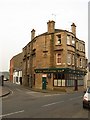
2
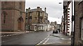
Main Street, Doune
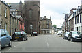
Looking along Main Street, past the church, towards a building containing a dress shop. This was once The Balhaldie, a pub. Image]
Image: © Richard Webb
Taken: 28 Mar 2010
0.01 miles
4
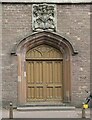
Doorway, Kilmadock Parish Church
The doorway is in the southern side of the tower of the church. The building was designed as Kilmadock East Church by James Gillespie Graham in 1822. The Moray coat of arms above the doorway commemorates the gift of the tower in 1823.
The building is Category B listed http://portal.historicenvironment.scot/designation/LB24697.
Image: © Richard Sutcliffe
Taken: 9 Jul 2021
0.03 miles
6
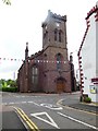
Former Church of Scotland, Doune
This Church is now disused.
Image: © Bill Henderson
Taken: 6 Jun 2013
0.04 miles
7
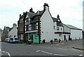
The Desirable Curio
An antiques shop on Main Street, Doune. The building dates from about 1900 and was previously a bakery. It is Category B listed http://portal.historicenvironment.scot/designation/LB43845.
Image: © Richard Sutcliffe
Taken: 9 Jul 2021
0.04 miles
8
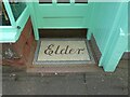
Doorstep mosaic
This mosaic spelling out 'Elder' is at the entrance to what is now 'The Desirable Curio' Image It presumably dates back to when the building was constructed in about 1900.
Image: © Richard Sutcliffe
Taken: 9 Jul 2021
0.04 miles
9
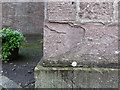
Ordnance Survey Cut Mark
This mark can be found on the wall of Kilmadock Parish Church in Doune. The benchmark height is recorded as being 38.501 metres above sea level. For more detail see : http://www.bench-marks.org.uk/bm89839
Image: © Peter Wood
Taken: 2 Oct 2017
0.04 miles
10
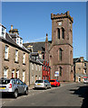
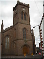
Kilmadock Parish Church, Doune
Category B listed [http://portal.historicenvironment.scot/designation/LB24697] church on Main Street, dating from the 1820s.
Image: © Richard Sutcliffe
Taken: 24 May 2018
0.04 miles