
IMAGES TAKEN NEAR TO
Springfield Drive, FALKIRK, FK1 5HP
Introduction
This page details the photographs taken nearby to Springfield Drive, FK1 5HP by members of the Geograph project.
The Geograph project started in 2005 with the aim of publishing, organising and preserving representative images for every square kilometre of Great Britain, Ireland and the Isle of Man.

There are currently over 7.5m images from over14,400 individuals and you can help contribute to the project by visiting https://www.geograph.org.uk
Image Map
Images are licensed for reuse under creativecommons.org/licenses/by-sa/2.0
Notes
- Clicking on the map will re-center to the selected point.
- The higher the marker number, the further away the image location is from the centre of the postcode.
Image Listing (36 Images Found)
Images are licensed for reuse under creativecommons.org/licenses/by-sa/2.0
Image
Details
Distance
2
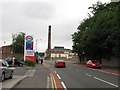
Camelon Road
This was once the A9. The industrial buildings on the right was a distillery, it is now partially demolished.
Image: © Richard Webb
Taken: 23 Jun 2010
0.11 miles
3
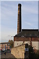
Old Rosebank Distillery
Remains of the old Rosebank Distillery in Falkirk, mothballed in 1993. Part of the distillery has been converted into a restaurant.
Image: © Colin Kinnear
Taken: 1 Nov 2010
0.12 miles
4
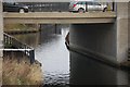
The Forth and Clyde Canal
The Forth and Clyde Canal where it passes under Camelon Road Falkirk.
Image: © Paul McIlroy
Taken: 15 Dec 2007
0.12 miles
5
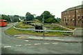
Lock 11 on the Forth and Clyde Canal at Camelon
The Forth and Clyde Canal was closed to navigation in the 1960s, but was reopened in 2001 following a major canal regeneration project called the Millennium Link.
At this location the canal had been culverted beneath the Camelon Road. The restoration involved digging out the canal bed, creating this new No.11 Lock to replace the original one further east, and building a new Camelon Road Bridge (parapet on right).
On the right, part of the Beefeater Restaurant building is seen. It was originally a bonded warehouse for the Rosebank Distillery.
Image: © Rose and Trev Clough
Taken: 20 Aug 2006
0.13 miles
6
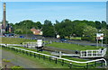
Falkirk Lock No 11 on the Forth and Clyde Canal
In the Camelon area of Falkirk. The chimney was part of the old Rosebank Distillery.
Image: © Mat Fascione
Taken: 31 May 2016
0.13 miles
7
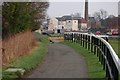
Forth and Clyde Canal Towpath
The Forth and Clyde Canal Towpath at Camelon. The view is towards the junction of Camelon Road and Glenfuir Road.
Image: © Paul McIlroy
Taken: 15 Dec 2007
0.13 miles
8
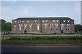
Premier Inn and Rosebank public house, Falkirk
Image: © Ian S
Taken: 1 Jun 2021
0.13 miles
9
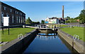
Falkirk Lock No 11 on the Forth and Clyde Canal
In the Camelon area of Falkirk. The chimney was part of the old Rosebank Distillery. The building on the left is the Rosebank Beefeater Grill Steak Restaurant.
Image: © Mat Fascione
Taken: 31 May 2016
0.13 miles
10
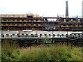
Rosebank Distillery
Partial demolition of the old distillery taking place. A new complex is beginning to take shape to form a new Distillery incorporating Visitor Experience, Cafe, retail, associated landscaping and car park.
Image: © Eirian Evans
Taken: 10 Sep 2021
0.14 miles