IMAGES TAKEN NEAR TO
Hamilton Street, FALKIRK, FK1 4QQ
Introduction
This page details the photographs taken nearby to Hamilton Street, FK1 4QQ by members of the Geograph project.
The Geograph project started in 2005 with the aim of publishing, organising and preserving representative images for every square kilometre of Great Britain, Ireland and the Isle of Man.

There are currently over 7.5m images from over14,400 individuals and you can help contribute to the project by visiting https://www.geograph.org.uk
Image Map
Images are licensed for reuse under creativecommons.org/licenses/by-sa/2.0
Notes
- Clicking on the map will re-center to the selected point.
- The higher the marker number, the further away the image location is from the centre of the postcode.
Image Listing (39 Images Found)
Images are licensed for reuse under creativecommons.org/licenses/by-sa/2.0
Image
Details
Distance
1
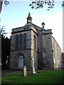
St John's Church, Camelon, Falkirk
The design seems practically identical to that of the church at Haggs Image
Image: © John Lord
Taken: 5 Oct 2011
0.07 miles
2
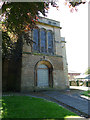
Former St John's parish church, Camelon, front
The former Church of Scotland building is category C listed (LB31234). It was built by architect David Rhind and opened in 1841, extended in the 1920s. It closed in 2003.
Image: © Stephen Craven
Taken: 27 Jun 2019
0.08 miles
3
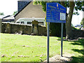
Former St John's parish church, Camelon, signboard
The congregation now worships elsewhere but the sign still gives contact details.
Image: © Stephen Craven
Taken: 27 Jun 2019
0.08 miles
4
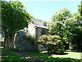
Former St John's parish church, Camelon, rear
The former Church of Scotland building is category C listed (LB31234). It was built by architect David Rhind and opened in 1841, extended in the 1920s. It closed in 2003.
Image: © Stephen Craven
Taken: 27 Jun 2019
0.08 miles
5
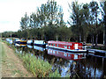
Forth and Clyde Canal
Narrowboats moored on the Forth and Clyde canal, not far from the Falkirk Wheel.
Image: © Ruth Harris
Taken: 20 Aug 2003
0.08 miles
6
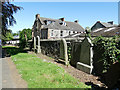
Former St John's parish church, Camelon, gravestones
Most of the gravestones from the churchyard have been cleared and the larger ones placed around the perimeter.
Image: © Stephen Craven
Taken: 27 Jun 2019
0.09 miles
7
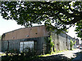
Derelict building on Carmuirs Street
An old map shows this and another building the other side of the road as "coach works", probably part of the Alexander coach builders, who as Alexander Dennis still have premises on Glasgow Road nearby.
Image: © Stephen Craven
Taken: 27 Jun 2019
0.11 miles
8
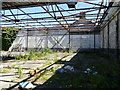
Inside a derelict building on Carmuirs Street
An old map shows this and another building the other side of the road as "coach works", probably part of the Alexander coach builders, who as Alexander Dennis still have premises on Glasgow Road nearby. See Image for the outside.
Image: © Stephen Craven
Taken: 27 Jun 2019
0.11 miles
9
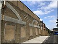
Coachworks wall, Brown Street
Retained former factory wall.
Image: © Richard Webb
Taken: 30 Aug 2024
0.11 miles