
IMAGES TAKEN NEAR TO
DOLLAR, FK14 7PL
Introduction
This page details the photographs taken nearby to FK14 7PL by members of the Geograph project.
The Geograph project started in 2005 with the aim of publishing, organising and preserving representative images for every square kilometre of Great Britain, Ireland and the Isle of Man.

There are currently over 7.5m images from over14,400 individuals and you can help contribute to the project by visiting https://www.geograph.org.uk
Image Map
Images are licensed for reuse under creativecommons.org/licenses/by-sa/2.0
Notes
- Clicking on the map will re-center to the selected point.
- The higher the marker number, the further away the image location is from the centre of the postcode.
Image Listing (17 Images Found)
Images are licensed for reuse under creativecommons.org/licenses/by-sa/2.0
Image
Details
Distance
1
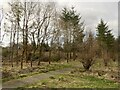
Path and windthrow, Law Hill Community Woodland
Image: © Richard Webb
Taken: 8 Apr 2022
0.04 miles
2

Law Hill Community Woodland
The trees have grown since 2005 - Image
Image: © Richard Webb
Taken: 9 Jan 2016
0.07 miles
3
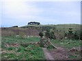
Law Hill Community Woodland
Tree topped Law Hill above Dollar.
Image: © Richard Webb
Taken: 7 Apr 2005
0.08 miles
5

Law Hill Community Woodland
A few years on from Image
Image: © Richard Webb
Taken: 9 Jan 2016
0.09 miles
6
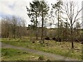
Law Hill Community Woodland
View into the woods from the car park which was full this morning. There has been some windthrow.
Image: © Richard Webb
Taken: 8 Apr 2022
0.09 miles
7
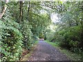
Driveway, Hillfoot
As well as the road access to Hillfoot House, this is the road into the forestry on Hillfoot Hill and a popular walking route. (NB there is a very narrow gate near Hillfoot House)
Image: © Richard Webb
Taken: 14 Sep 2013
0.12 miles
8

Path, Hillfoot
A handy connection from Law Hill car park to the Castle Campbell car park through recently felled woodland.
Image: © Richard Webb
Taken: 9 Jan 2016
0.22 miles
9

Path, Hillfoot
A mountainbike track crossing the boundary mapped by the Ordnance Survey, an old ruined wall.
Image: © Richard Webb
Taken: 8 Apr 2022
0.23 miles
10

Path, Hillfoot
The frost helped, firming up some of the squelchy bits.
Image: © Richard Webb
Taken: 9 Jan 2016
0.24 miles