
IMAGES TAKEN NEAR TO
Upper Yetts, DOLLAR, FK14 7JU
Introduction
This page details the photographs taken nearby to FK14 7JU by members of the Geograph project.
The Geograph project started in 2005 with the aim of publishing, organising and preserving representative images for every square kilometre of Great Britain, Ireland and the Isle of Man.

There are currently over 7.5m images from over14,400 individuals and you can help contribute to the project by visiting https://www.geograph.org.uk
Image Map
Images are licensed for reuse under creativecommons.org/licenses/by-sa/2.0
Notes
- Clicking on the map will re-center to the selected point.
- The higher the marker number, the further away the image location is from the centre of the postcode.
Image Listing (14 Images Found)
Images are licensed for reuse under creativecommons.org/licenses/by-sa/2.0
Image
Details
Distance
1
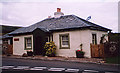
Former Tollhouse by the A823, Yetts o' Muckhart, Dollar
Yetts o' Muckhart by the A823, in parish of MUCKHART (Clackmannan District), The Old Toll House, Upper Yetts o' Muckhart, Dollar, FK14 7JT.
HES Grade B listed.
Reference: LB15243 http://portal.historicenvironment.scot/designation/LB15243
Surveyed
Milestone Society National ID: CL.MUC
Image: © Milestone Society
Taken: Unknown
0.01 miles
2
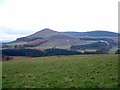
Seamab View
View SW to Seamab Hill from lower slopes of Lendrick Hill
Image: © Alfred Fyfe
Taken: 19 Nov 2006
0.07 miles
3
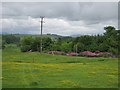
Field, Yetts o' Muckhart
The buttercup filled field is between a pair of roads which meet at a complex junction nearby.
Image: © Richard Webb
Taken: 17 Jun 2012
0.10 miles
4
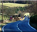
The A91 near Yetts o' Muckhart
The A91 runs from Bannockburn to St Andrews, this section is approaching the point where the road crosses the river Devon near Yetts o' Muckhart.
Image: © Paul McIlroy
Taken: 30 Jan 2008
0.14 miles
5
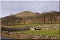
Between the A91 and A823, Yetts o' Muckhart
The two roads are close together under Seamab Hill. The enclosure is part of the water supply network.
Image: © Richard Webb
Taken: 3 Dec 2017
0.14 miles
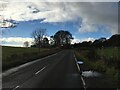
7
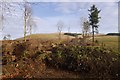
Felled area, Upper Yetts
This plantation Image, recently clear felled.
Image: © Richard Webb
Taken: 3 Dec 2017
0.16 miles
8
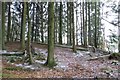
Woodland near Upper Yetts
Mature conifers above the River Devon.
Image: © Richard Webb
Taken: 17 Jan 2015
0.16 miles
9
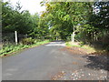
Road (B934) near Upper Yetts
Looking northward.
Image: © Peter Wood
Taken: 30 Sep 2017
0.17 miles
10
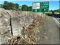
Old milestone
This granite milestone is at the complex junction at Yetts o' Muckhart of the A91 from west to east and the A823 from south to north. As the years pass, the 18 painted on both faces in black is slowly fading away. It is one of only two milestones that have been found in Clackmannanshire. It is on HES Canmore 353389.
Image: © Hilary Jones
Taken: 10 Sep 2022
0.18 miles