
IMAGES TAKEN NEAR TO
Malcolm Court, DOLLAR, FK14 7HY
Introduction
This page details the photographs taken nearby to Malcolm Court, FK14 7HY by members of the Geograph project.
The Geograph project started in 2005 with the aim of publishing, organising and preserving representative images for every square kilometre of Great Britain, Ireland and the Isle of Man.

There are currently over 7.5m images from over14,400 individuals and you can help contribute to the project by visiting https://www.geograph.org.uk
Image Map
Images are licensed for reuse under creativecommons.org/licenses/by-sa/2.0
Notes
- Clicking on the map will re-center to the selected point.
- The higher the marker number, the further away the image location is from the centre of the postcode.
Image Listing (29 Images Found)
Images are licensed for reuse under creativecommons.org/licenses/by-sa/2.0
Image
Details
Distance
1
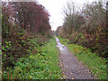
Devon Way with two bridges
The Devon Way follows the line of an old railway between Dollar and Tillicoultry. It runs in a slight cutting just to the south of Dollar so is crossed by two road bridges.
Image: © Lis Burke
Taken: 13 Nov 2010
0.04 miles
2
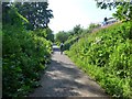
On the Devon Way
Note - not county Devon, but river Devon! This runs on a disused railway track-bed.
Image: © Gordon Brown
Taken: 18 Jul 2017
0.10 miles
3
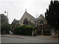
Former Dollar Free Church
Now housing.
Image: © Jonathan Thacker
Taken: 17 Aug 2018
0.11 miles
4
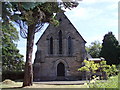
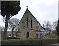
St James the Great Church
Church in Dollar
Image: © Angela Mudge
Taken: 17 Jul 2006
0.11 miles
5
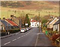
Dollar
Looking northwards along Devon Road towards Bridge Street and the lower slopes of Bank Hill.
Image: © Paul McIlroy
Taken: 16 Dec 2006
0.12 miles
7
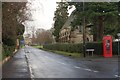
Dollar
A view along Mylne Avenue to Dollar Academy,the church on the right is the Scottish Episcopalian Church of St. James The Great. The Scottish Episcopalians are affiliated to The Church of England.
Image: © Paul McIlroy
Taken: 30 Dec 2006
0.13 miles
8

Ordnance Survey Flush Bracket S5118
This bracket can be found on the wall of a former church building - now a private dwelling - in Harviestoun Road, Dollar. The benchmark height is recorded as being 40.981 metres above sea level. For more detail see : http://www.bench-marks.org.uk/bm476
Image: © Peter Wood
Taken: 30 Sep 2017
0.13 miles
9
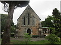
Church of St. James the Great, Dollar
Episcopal church dating from 1879-82.
Image: © Jonathan Thacker
Taken: 17 Aug 2018
0.13 miles
10
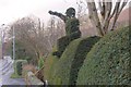
Topiary
I think he is supposed to be waving to the passing traffic, on the A91 at Dollar.
Image: © Paul McIlroy
Taken: 30 Dec 2006
0.13 miles