
IMAGES TAKEN NEAR TO
Slamannan, FALKIRK, FK1 3DW
Introduction
This page details the photographs taken nearby to FK1 3DW by members of the Geograph project.
The Geograph project started in 2005 with the aim of publishing, organising and preserving representative images for every square kilometre of Great Britain, Ireland and the Isle of Man.

There are currently over 7.5m images from over14,400 individuals and you can help contribute to the project by visiting https://www.geograph.org.uk
Image Map
Images are licensed for reuse under creativecommons.org/licenses/by-sa/2.0
Notes
- Clicking on the map will re-center to the selected point.
- The higher the marker number, the further away the image location is from the centre of the postcode.
Image Listing (7 Images Found)
Images are licensed for reuse under creativecommons.org/licenses/by-sa/2.0
Image
Details
Distance
1
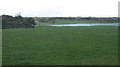
Grassland, Hillend
Grazing land by a dairy farm - the stock were indoors. Floods along the Avon in the background.
Image: © Richard Webb
Taken: 20 Nov 2009
0.03 miles
2

Hillend Farm
Hillend has a large herd of Friesians, still indoors in late March. The village of Slamannan is in the background.
Image: © Anne Burgess
Taken: 25 Mar 2015
0.05 miles
3
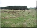
Rashy ground by Hillend
Wet grassland, but not as wet as neighbouring fields which were flooded by the Avon after very heavy rainfall.
Image: © Richard Webb
Taken: 20 Nov 2009
0.07 miles
4
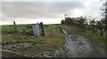
Road to Rashiehill
The end of the public road at Hillend. The road carries on to Rashiehill and ends amongst new forestry further west.
Image: © Richard Webb
Taken: 20 Nov 2009
0.10 miles
5
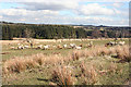
Sheep at Rashiehill
The house is abandoned and the rushes are returning to the land, but it still supports a large flock of sheep.
Image: © Anne Burgess
Taken: 25 Mar 2015
0.21 miles
6
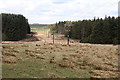
Power Line
Interestingly, the larger-scale maps show the gap in the forest, but not the power line which is the reason for the gap.
Image: © Anne Burgess
Taken: 25 Mar 2015
0.22 miles
7
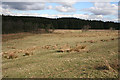
Towards Hillend Wood
The grassy fields in the foreground belong to Rashiehill.
Image: © Anne Burgess
Taken: 25 Mar 2015
0.23 miles