IMAGES TAKEN NEAR TO
Slamannan, FALKIRK, FK1 3DS
Introduction
This page details the photographs taken nearby to FK1 3DS by members of the Geograph project.
The Geograph project started in 2005 with the aim of publishing, organising and preserving representative images for every square kilometre of Great Britain, Ireland and the Isle of Man.

There are currently over 7.5m images from over14,400 individuals and you can help contribute to the project by visiting https://www.geograph.org.uk
Image Map
Images are licensed for reuse under creativecommons.org/licenses/by-sa/2.0
Notes
- Clicking on the map will re-center to the selected point.
- The higher the marker number, the further away the image location is from the centre of the postcode.
Image Listing (13 Images Found)
Images are licensed for reuse under creativecommons.org/licenses/by-sa/2.0
Image
Details
Distance
1
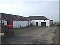
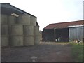
Shortrig Farm
The baulks of timber at the angle of the buildings are attached to a rope passing over the corrugated iron roof,presumably to hold it on in high winds.
Image: © John Lord
Taken: 26 Sep 2008
0.01 miles
2
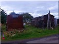
Shortrig Farm, British Rail surplus
Two old surplus British Railways 'Closed Goods' vans which maybe date back to the early 1960s and the Beeching cuts of the railway network. The one on the left has been repaired using some corrugated sheeting.
Image: © Robert Murray
Taken: 15 Aug 2011
0.01 miles
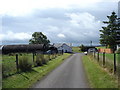
3
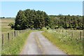
Shortrig Farm
Approaching from the east.
Image: © Robert Murray
Taken: 15 Aug 2011
0.01 miles

6
Shortrig Farm ,Slamannan near Falkirk
Many of these small farms have been renovated and are very much part-time farms. Much of the farmland has been forested or has recently been subjected to open cast mining operations.
Image: © paul birrell
Taken: 1 Aug 2006
0.10 miles
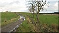
7
Shortrig, road west
Taking another dip to cross a burn.
Image: © Robert Murray
Taken: 15 Aug 2011
0.13 miles
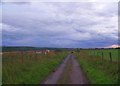
8
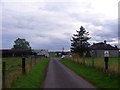
Minor road, Shortrig
The public road is a dead end but a track continues to the west.
Image: © Richard Webb
Taken: 20 Nov 2009
0.13 miles
9
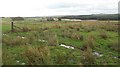
Wet ground, Shortrig
Rashy ground above the flooded wetlands surrounding the upper Avon.
Image: © Richard Webb
Taken: 20 Nov 2009
0.14 miles