
IMAGES TAKEN NEAR TO
Glebe Crescent, ALVA, FK12 5HS
Introduction
This page details the photographs taken nearby to Glebe Crescent, FK12 5HS by members of the Geograph project.
The Geograph project started in 2005 with the aim of publishing, organising and preserving representative images for every square kilometre of Great Britain, Ireland and the Isle of Man.

There are currently over 7.5m images from over14,400 individuals and you can help contribute to the project by visiting https://www.geograph.org.uk
Image Map
Images are licensed for reuse under creativecommons.org/licenses/by-sa/2.0
Notes
- Clicking on the map will re-center to the selected point.
- The higher the marker number, the further away the image location is from the centre of the postcode.
Image Listing (8 Images Found)
Images are licensed for reuse under creativecommons.org/licenses/by-sa/2.0
Image
Details
Distance
2
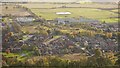
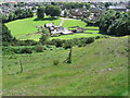
Alva from the Silver Glen
A view from the steep Ochils escarpment. The big building is Alva Academy.
Image: © Richard Webb
Taken: 5 Nov 2016
0.20 miles
3
A vacant site, Alva
An open area which was once built upon.
Image: © Richard Webb
Taken: 17 Jun 2012
0.21 miles
4
Brook Street in Alva
Looking north-westward with the flank of Wee Torry in the background.
Image: © Peter Wood
Taken: 30 Sep 2017
0.21 miles
6
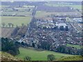
Keir Hardie Road, Alva
View from the hill road at the top of the zigzags.
Image: © Richard Webb
Taken: 7 Feb 2023
0.22 miles
7
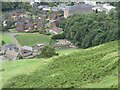
Sheep penning in Alva
Looking down from the hillside to sheep being penned at Rhodders Farm on the northern edge of Alva.
Image: © Scott Cormie
Taken: 30 Aug 2020
0.23 miles
8
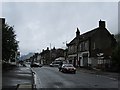
Stirling Street, Alva
The A91 Hillfoots road passes through Alva.
Image: © Richard Webb
Taken: 17 Jun 2012
0.24 miles