IMAGES TAKEN NEAR TO
Stirling Road, ALVA, FK12 5BP
Introduction
This page details the photographs taken nearby to Stirling Road, FK12 5BP by members of the Geograph project.
The Geograph project started in 2005 with the aim of publishing, organising and preserving representative images for every square kilometre of Great Britain, Ireland and the Isle of Man.

There are currently over 7.5m images from over14,400 individuals and you can help contribute to the project by visiting https://www.geograph.org.uk
Image Map
Images are licensed for reuse under creativecommons.org/licenses/by-sa/2.0
Notes
- Clicking on the map will re-center to the selected point.
- The higher the marker number, the further away the image location is from the centre of the postcode.
Image Listing (14 Images Found)
Images are licensed for reuse under creativecommons.org/licenses/by-sa/2.0
Image
Details
Distance
1
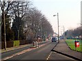
Approaching Alva from the west
Low cloud lying along the bottom of the hillfoots - a mile south and glorious sunshine.
Image: © Gordon Brown
Taken: 12 Feb 2008
0.04 miles
2
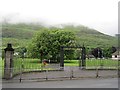
Cochrane Park, Alva
A park at the foot of the steep Ochil escarpment.
Image: © Richard Webb
Taken: 17 Jun 2012
0.06 miles
3
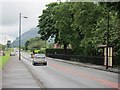
Stirling Road, Alva
The A91 looking westward.
Image: © Richard Webb
Taken: 17 Jun 2012
0.09 miles
4
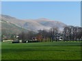
Across Alva Park to the Ochils
A streak of low cloud still lying at the bottom of the Hills.
Image: © Gordon Brown
Taken: 12 Feb 2008
0.12 miles
5
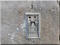
Ordnance Survey Flush Bracket S5122
This bracket can be found on the wall of the former Dalmore Centre - now private dwellings - in Alva. The benchmark height is recorded as being 18.297 metres above sea level. For more detail see : http://www.bench-marks.org.uk/bm11367
Image: © Peter Wood
Taken: 30 Sep 2017
0.13 miles
6
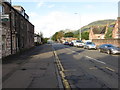
West Stirling Street (A91) in Alva
Looking westward.
Image: © Peter Wood
Taken: 30 Sep 2017
0.13 miles
7
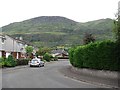
Viewfield Drive, Alva
A loop in a residential street with the Ochil escarpment as a backdrop.
Image: © Richard Webb
Taken: 31 Aug 2011
0.14 miles
8
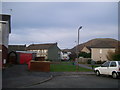
Corner of an estate, Alva
Built on the edge of the old railway, which terminated in Alva. Post 1940s map.
Image: © Kirsty Smith
Taken: 29 Nov 2005
0.14 miles