
IMAGES TAKEN NEAR TO
Hawley Road, FALKIRK, FK1 1SW
Introduction
This page details the photographs taken nearby to Hawley Road, FK1 1SW by members of the Geograph project.
The Geograph project started in 2005 with the aim of publishing, organising and preserving representative images for every square kilometre of Great Britain, Ireland and the Isle of Man.

There are currently over 7.5m images from over14,400 individuals and you can help contribute to the project by visiting https://www.geograph.org.uk
Image Map
Images are licensed for reuse under creativecommons.org/licenses/by-sa/2.0
Notes
- Clicking on the map will re-center to the selected point.
- The higher the marker number, the further away the image location is from the centre of the postcode.
Image Listing (21 Images Found)
Images are licensed for reuse under creativecommons.org/licenses/by-sa/2.0
Image
Details
Distance
1
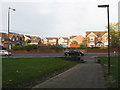
Callendar Park Drive
Newish housing across Callendar Road, seen from the path into Callendar Park and Seaton Place.
Image: © M J Richardson
Taken: 27 Oct 2012
0.14 miles
2
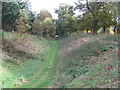
Rampart and ditch of the Antonine Wall
Seen from the path leading from Callendar Road to Seaton Place and Callendar Park.
Image: © M J Richardson
Taken: 27 Oct 2012
0.19 miles
3

The ditch associated with the Antonine Wall
Image: © Elliott Simpson
Taken: Unknown
0.19 miles
4
![Falkirk, Callendar Park [2]](https://s3.geograph.org.uk/geophotos/04/64/74/4647427_d33c3c23_120x120.jpg)
Falkirk, Callendar Park [2]
The ditch of the Antonine Wall (Ad 142)
Image: © Robert Murray
Taken: 5 Sep 2015
0.19 miles
5
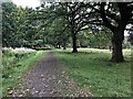
Oaks and path, Callendar Park
Beside the Antonine Wall.
Image: © Richard Webb
Taken: 22 Sep 2023
0.20 miles
6
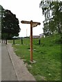
Signpost on the Antonine Wall
As it was built of turf, the Antonine Wall which only served as the northern frontier of the Roman Empire from AD 142 to 165 is much less well-preserved than its more southerly cousin, Hadrians Wall. However the significance of both is recognised in their World Heritage Site status.
Image: © Oliver Dixon
Taken: 3 Jun 2021
0.20 miles
7
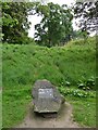
The Antonine Wall
Stone and plaque commemorating the Antonine Wall, part of which can be seen in the background. As it was built of turf, the Antonine Wall which only served as the northern frontier of the Roman Empire from AD 142 to 165 is much less well-preserved than its more southerly cousin, Hadrians Wall. However the significance of both is recognised in their World Heritage Site status.
Image: © Oliver Dixon
Taken: 3 Jun 2021
0.20 miles
8
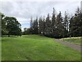
Antonine Wall, Callendar Park
Mounds and ditches in a well preserved section of the monument.
Image: © Richard Webb
Taken: 22 Sep 2023
0.20 miles
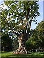
10
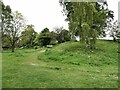
The Antonine Wall
As it was built of turf, the Antonine Wall which only served as the northern frontier of the Roman Empire from AD 142 to 165 is much less well-preserved than its more southerly cousin, Hadrians Wall. However the significance of both is recognised in their World Heritage Site status.
Image: © Oliver Dixon
Taken: 3 Jun 2021
0.22 miles