IMAGES TAKEN NEAR TO
ALLOA, FK10 3AL
Introduction
This page details the photographs taken nearby to FK10 3AL by members of the Geograph project.
The Geograph project started in 2005 with the aim of publishing, organising and preserving representative images for every square kilometre of Great Britain, Ireland and the Isle of Man.

There are currently over 7.5m images from over14,400 individuals and you can help contribute to the project by visiting https://www.geograph.org.uk
Image Map
Images are licensed for reuse under creativecommons.org/licenses/by-sa/2.0
Notes
- Clicking on the map will re-center to the selected point.
- The higher the marker number, the further away the image location is from the centre of the postcode.
Image Listing (5 Images Found)
Images are licensed for reuse under creativecommons.org/licenses/by-sa/2.0
Image
Details
Distance
1
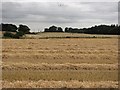
Straw rows, King o' Muir
A recently harvested field near Glenochil.
Image: © Richard Webb
Taken: 31 Aug 2011
0.12 miles
2
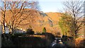
Track, Glenochil
Signposted footpath with the very steep Hillfoots scarp in the background.
Image: © Richard Webb
Taken: 6 Feb 2013
0.18 miles
3
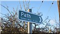
Footpath sign, Glenochil
Clackmannanshire Council path sign. The path is a vehicle track.
Image: © Richard Webb
Taken: 6 Feb 2013
0.19 miles
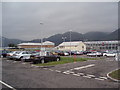
4
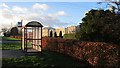
Bus stop, Glenochil
In Clackmannanshire Council red.
Image: © Richard Webb
Taken: 6 Feb 2013
0.20 miles