
IMAGES TAKEN NEAR TO
Auld Brig Road, ALLOA, FK10 2PF
Introduction
This page details the photographs taken nearby to Auld Brig Road, FK10 2PF by members of the Geograph project.
The Geograph project started in 2005 with the aim of publishing, organising and preserving representative images for every square kilometre of Great Britain, Ireland and the Isle of Man.

There are currently over 7.5m images from over14,400 individuals and you can help contribute to the project by visiting https://www.geograph.org.uk
Image Map
Images are licensed for reuse under creativecommons.org/licenses/by-sa/2.0
Notes
- Clicking on the map will re-center to the selected point.
- The higher the marker number, the further away the image location is from the centre of the postcode.
Image Listing (6 Images Found)
Images are licensed for reuse under creativecommons.org/licenses/by-sa/2.0
Image
Details
Distance
1
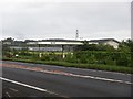
Closed filling station, Tullibody
This closed petrol station has a colourful history. MVPA was the Motor Vehicle Protection Association and its remit was to sell tax free fuel to members of a private club under the excuse that it was being used for "scientific research". This of course brought down the wrath of the 'Cise men, and Customs and Excise raided the place in 2007.
Later there was a police incident when the tenant (who was behind MVPA) resisted eviction.
Image: © Richard Webb
Taken: 18 May 2011
0.03 miles
2

Oilseed rape, East Gogar
Arable land between the vast area of bonded warehouses north of the Forth and the Ochil scarp.
Image: © Richard Webb
Taken: 18 May 2011
0.09 miles
3
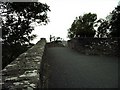
Tullibody Bridge
This bridge is the oldest structure in Clackmannanshire being built around 1697 by Thomas and Tobias Bauchop. It is a category A scheduled ancient monument built over the River Devon.
Image: © Jennie Hodson
Taken: 22 Sep 2004
0.13 miles
4
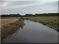
The River Devon
This photograph is taken standing on the old Tullibody Bridge south. On the horizon directly above the river the roofs of the bonded warehouses behind the trees can be seen.
Image: © Jennie Hodson
Taken: 22 Sep 2004
0.16 miles
5
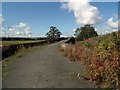
Tullibody Old Bridge
It is believed that Tullibody Old Bridge was constructed in the early 16th century by Robert Spittal, court tailor to James IV. In 1560, the eastern-most arch was demolished by Sir William Kirkcaldy of Grange to impede an advance on Stirling by French soldiers during the regency of Mary of Guise. In 1697, a major repair on the bridge was undertaken by the mason Thomas Bauchop.
Image: © Euan Nelson
Taken: 5 Sep 2011
0.16 miles
6
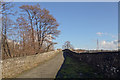
Tullibody Old Bridge
The bridge was built in the early 16th centur. The road which it once carried is now a cycle path. The southerly half of the road is shaded by the wall of the bridge, get's no direct sunlight in winter and so provides a perfect damp and undisturbed surface on which moss grows.
Image: © Doug Lee
Taken: 3 Mar 2014
0.16 miles