
IMAGES TAKEN NEAR TO
Redwell Place, ALLOA, FK10 2BT
Introduction
This page details the photographs taken nearby to Redwell Place, FK10 2BT by members of the Geograph project.
The Geograph project started in 2005 with the aim of publishing, organising and preserving representative images for every square kilometre of Great Britain, Ireland and the Isle of Man.

There are currently over 7.5m images from over14,400 individuals and you can help contribute to the project by visiting https://www.geograph.org.uk
Image Map
Images are licensed for reuse under creativecommons.org/licenses/by-sa/2.0
Notes
- Clicking on the map will re-center to the selected point.
- The higher the marker number, the further away the image location is from the centre of the postcode.
Image Listing (13 Images Found)
Images are licensed for reuse under creativecommons.org/licenses/by-sa/2.0
Image
Details
Distance
1
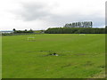
Playing field at Alloa
In the old county of Clackmannanshire.
Image: © James Denham
Taken: 28 May 2011
0.09 miles
4
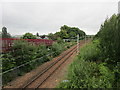
Railway to Stirling
The electrification masts and overhead have been installed but are not yet in use.
Image: © Jonathan Thacker
Taken: 17 Aug 2018
0.14 miles
5
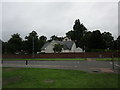
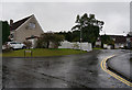
Kingdom Hall of Jehovah's Witnesses
Adjacent to a pedestrian crossing on Stirling Road.
Image: © Jonathan Thacker
Taken: 17 Aug 2018
0.15 miles
6
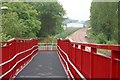
New footbridge
New footbridge over a new railway line.
Image: © Paul McIlroy
Taken: 8 Jun 2007
0.16 miles
7
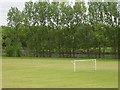
Playing fields, Alloa
Football pitches beside the railway to Stirling which was being rebuilt at this time.
Image: © Richard Webb
Taken: 4 Jun 2006
0.17 miles
8
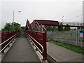
Footbridge over the railway
At the end of Grange Road.
Image: © Jonathan Thacker
Taken: 17 Aug 2018
0.19 miles
10
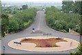
Roundabout
On the Alloa to Stirling road (A907) gives access to Alloa Technology Park.
Image: © Paul McIlroy
Taken: 8 Jun 2007
0.21 miles