IMAGES TAKEN NEAR TO
Smithfield Meadows, ALLOA, FK10 1TF
Introduction
This page details the photographs taken nearby to Smithfield Meadows, FK10 1TF by members of the Geograph project.
The Geograph project started in 2005 with the aim of publishing, organising and preserving representative images for every square kilometre of Great Britain, Ireland and the Isle of Man.

There are currently over 7.5m images from over14,400 individuals and you can help contribute to the project by visiting https://www.geograph.org.uk
Image Map
Images are licensed for reuse under creativecommons.org/licenses/by-sa/2.0
Notes
- Clicking on the map will re-center to the selected point.
- The higher the marker number, the further away the image location is from the centre of the postcode.
Image Listing (6 Images Found)
Images are licensed for reuse under creativecommons.org/licenses/by-sa/2.0
Image
Details
Distance
1
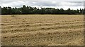
Harvested field
Recently harvested cereal crop on the edge of an industrial area of Alloa.
Image: © Richard Webb
Taken: 2 Sep 2011
0.15 miles
2

Offices, Alloa
Newly built offices awaiting tenants.
Image: © Richard Webb
Taken: 18 Sep 2009
0.15 miles
3
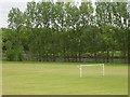
Playing fields, Alloa
Football pitches beside the railway to Stirling which was being rebuilt at this time.
Image: © Richard Webb
Taken: 4 Jun 2006
0.17 miles
4
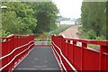
New footbridge
New footbridge over a new railway line.
Image: © Paul McIlroy
Taken: 8 Jun 2007
0.18 miles
5
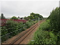
Railway to Stirling
The electrification masts and overhead have been installed but are not yet in use.
Image: © Jonathan Thacker
Taken: 17 Aug 2018
0.21 miles
6
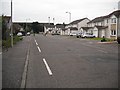
Bellevue Road, Alloa
Now a fully residential street; recent aerial photographs show a factory where the new houses are on the right.
The road carries route 76 of the National Cycle Network.i
Image: © Richard Webb
Taken: 18 Sep 2009
0.23 miles