1
Ruined church, Alloa
Also see http://www.bbc.co.uk/arts/yourpaintings/paintings/the-old-kirk-alloa-162728
Image: © Basher Eyre
Taken: 12 Aug 2014
0.02 miles
2
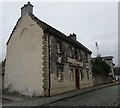
25 Kirkgate, Alloa
Dates from 1695. Designed and built by Tobias Bachop for himself.
Image: © Jonathan Thacker
Taken: 17 Aug 2018
0.02 miles
3
Alloa
This Coalgate where it joins Mill Street.
Image: © Paul McIlroy
Taken: 8 Jun 2007
0.02 miles
4
Sundial, Star House, Kirkgate, Alloa
This fine sundial is carved above the front door of Star House (25 Kirkgate). The house was built in 1695 by master builder Tobias Bauchop as his townhouse. The metalwork of the sundial's gnomons are missing, but the carving is still in very good condition. Below is a cartouche with
1695
TB
ML
The house and sundial are Category A listed.
Image: © Richard Sutcliffe
Taken: 18 May 2019
0.02 miles
5
Old St. Mungo's church, Alloa
These parts date from the 1680s. Most of the church was demolished in 1817 when replaced by a new church in Bedford Place
Image
Image: © Jonathan Thacker
Taken: 17 Aug 2018
0.02 miles
6
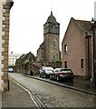
Bell tower, Old Parish Church, Alloa
The west gable with the bell-tower, are all that is left of the medieval parish church, which is a Scheduled monument. Behind is the Mar And Kellie Mausoleum [https://www.geograph.org.uk/photo/6158605]. Seen from Kirkgate.
Image: © Richard Sutcliffe
Taken: 18 May 2019
0.02 miles
7
Bell tower, Old Parish Church, Alloa
The west gable with the bell-tower, are all that are left of the medieval parish church, which is a Scheduled monument. Seen from Kirkgate.
In the distance is the spire of St John's Church on Broad Street.
Image: © Richard Sutcliffe
Taken: 18 May 2019
0.02 miles
8
Mar And Kellie Mausoleum
Gothic mausoleum dating from 1819, attributed to James Gillespie Graham. It is situated in the graveyard beside the ruins of the old parish church and is Category B listed. Seen from Kirkgate.
Image: © Richard Sutcliffe
Taken: 18 May 2019
0.02 miles
9
Mausoleum of the Earls of Mar
Replaced the 'Mar Aisle' of the former St. Mungo's church. Dates from 1819. the architect was James Gillespie Graham.
Image: © Jonathan Thacker
Taken: 17 Aug 2018
0.02 miles
10
Union Street, Brewery, Alloa
Image: © Jonathan Thacker
Taken: 17 Aug 2018
0.04 miles


